Fire lookout towers in the Angeles and San Bernardino National Forest

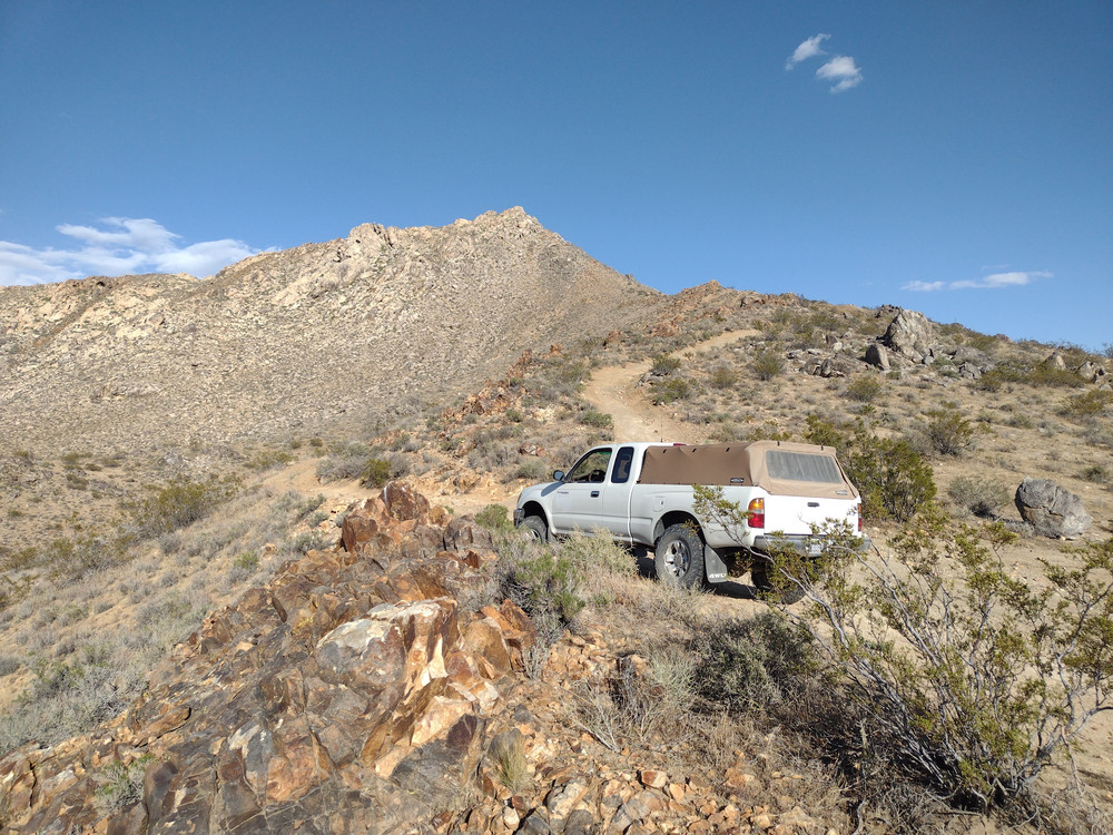
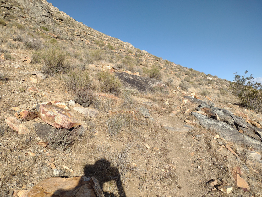
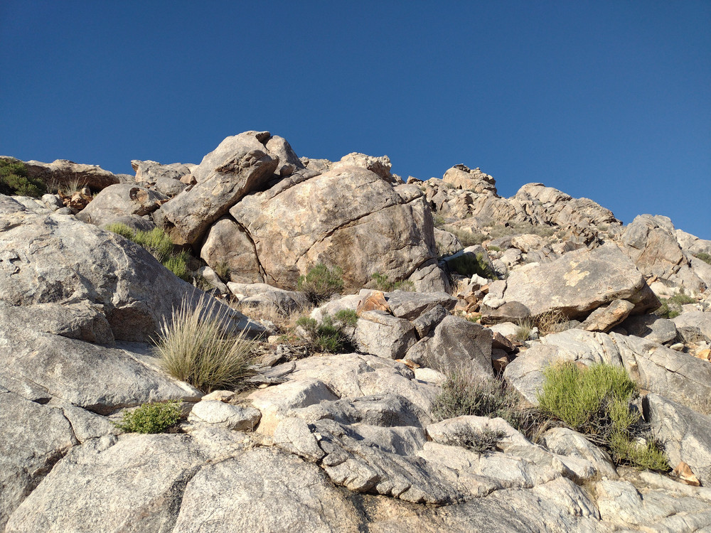
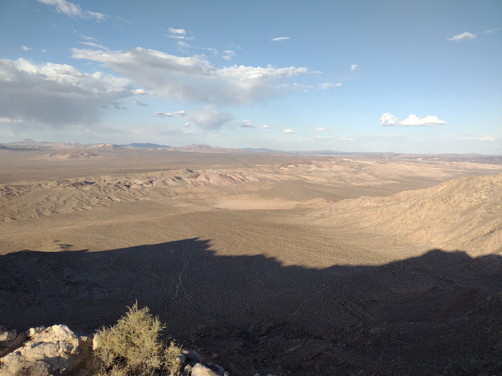
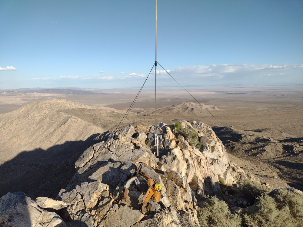
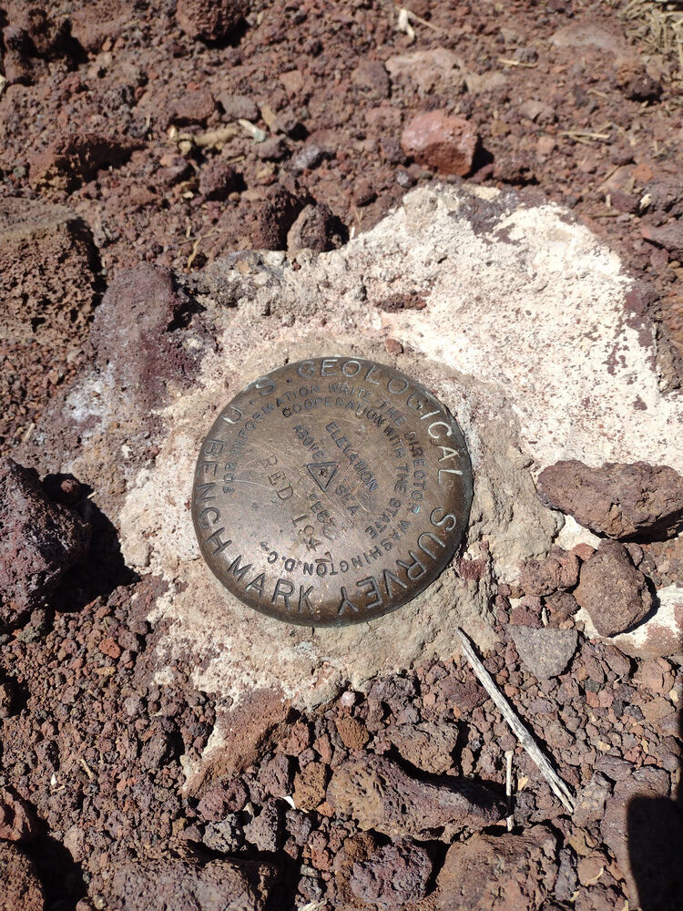
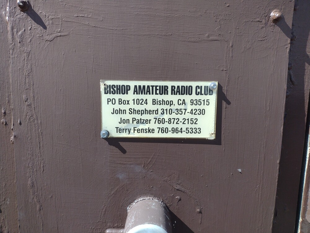
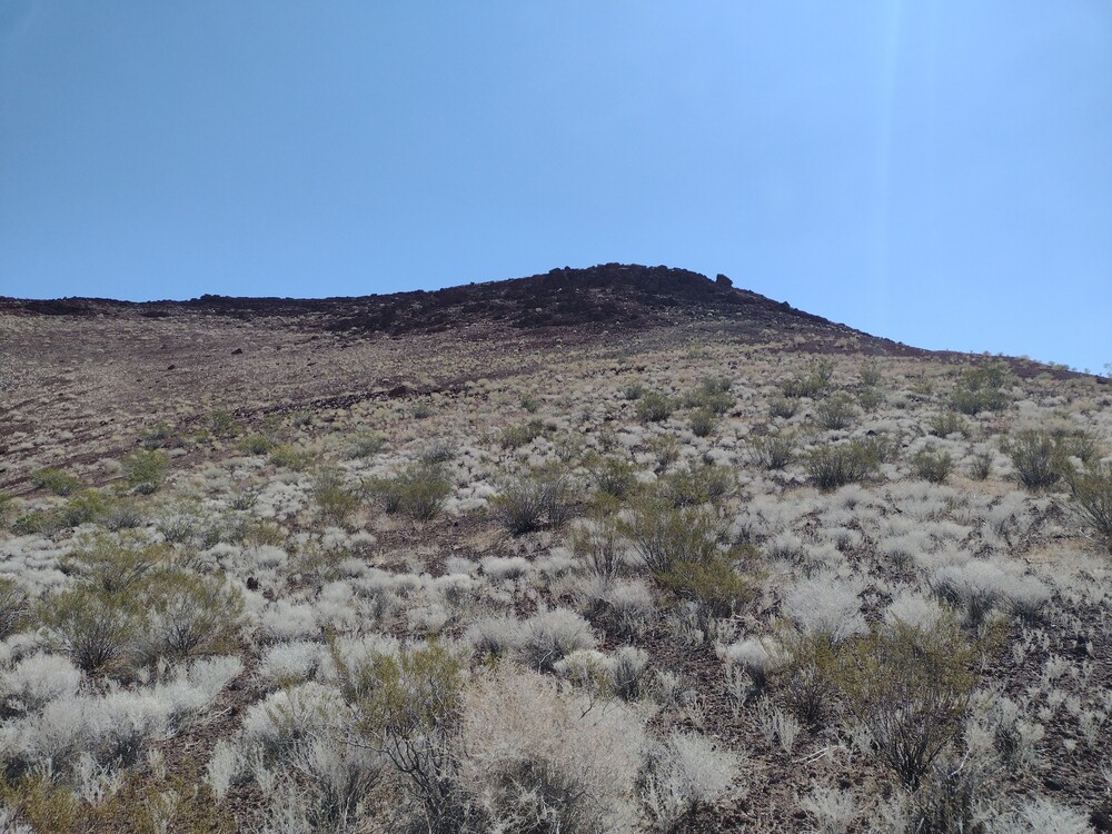
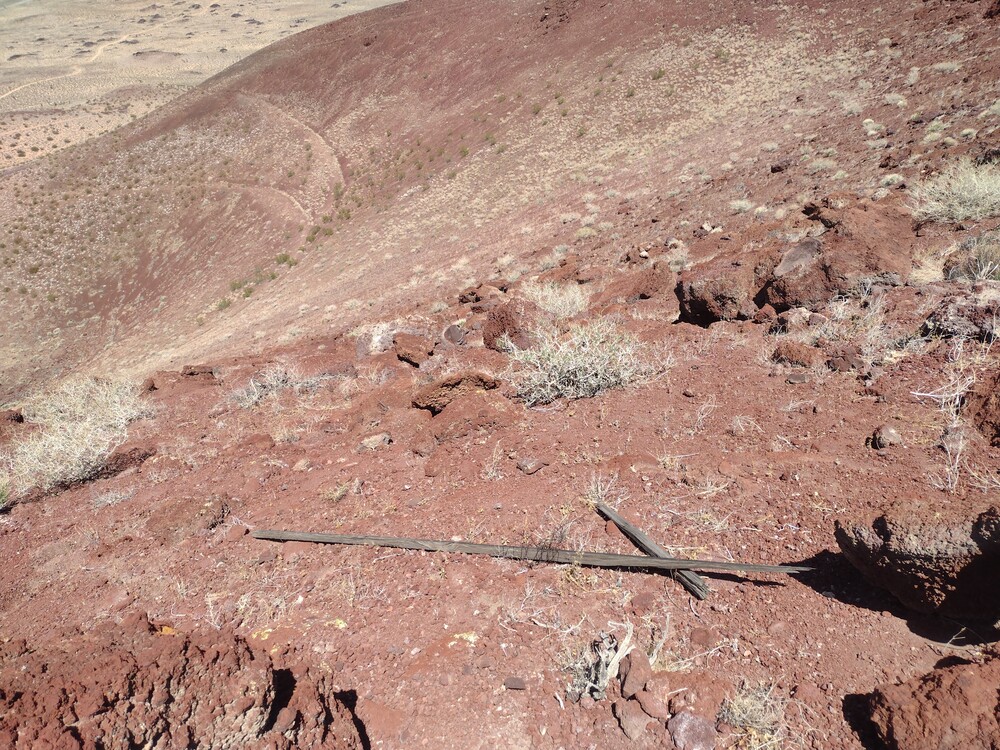
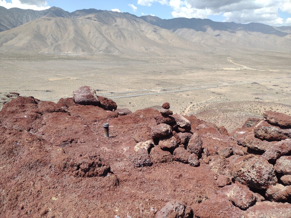
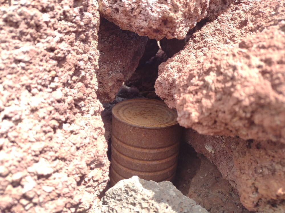
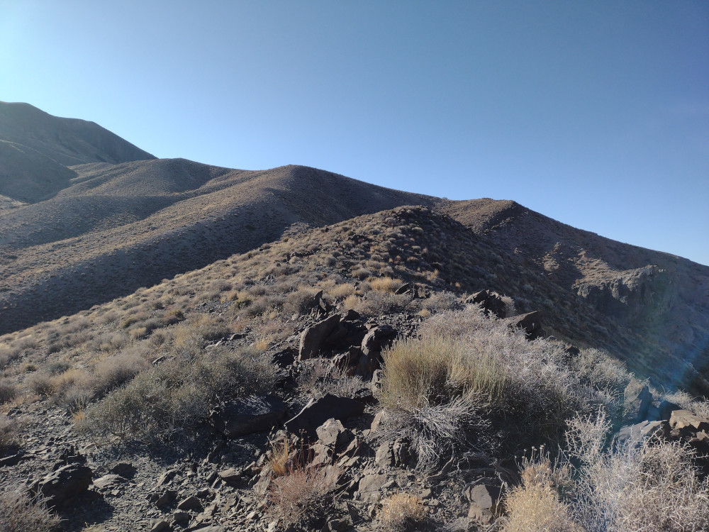
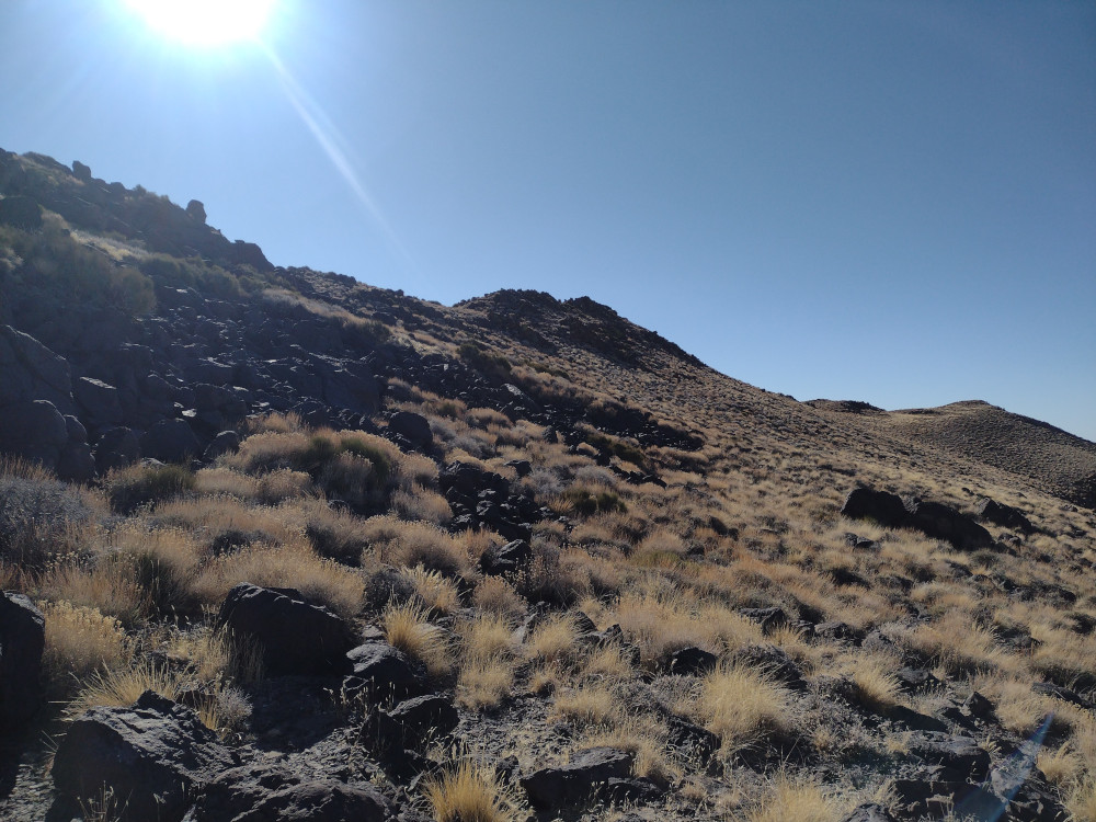
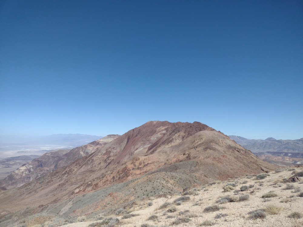
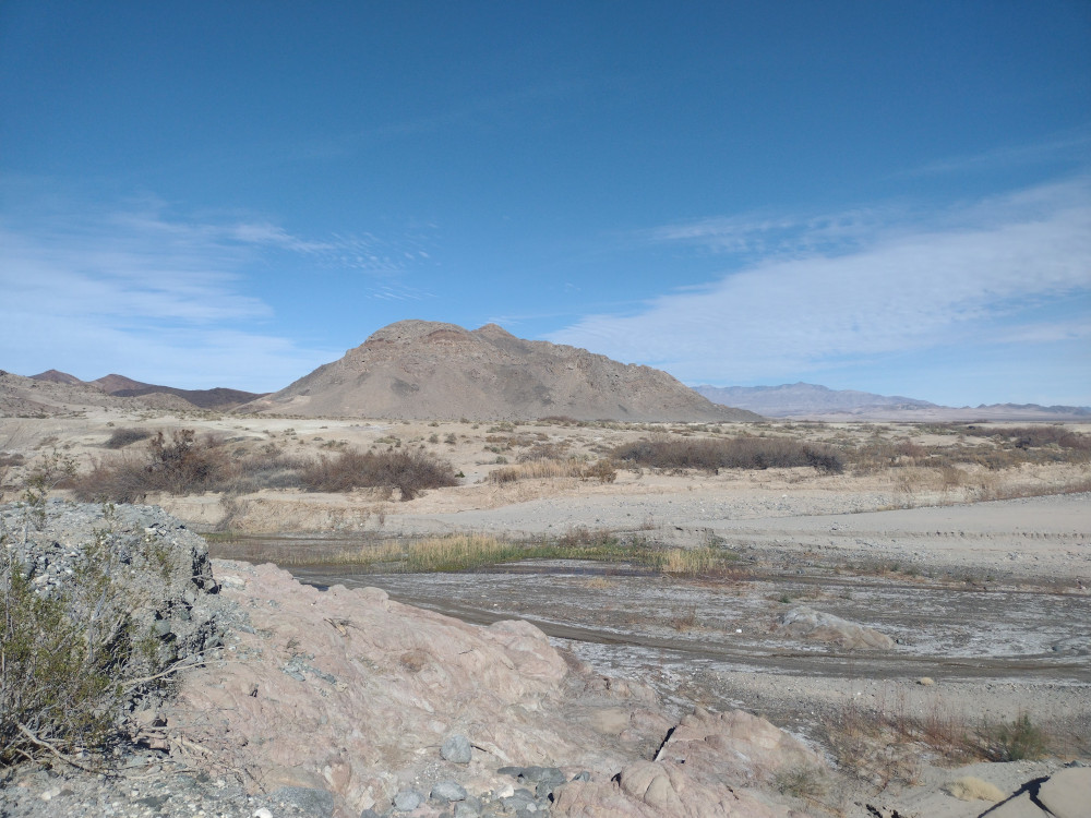
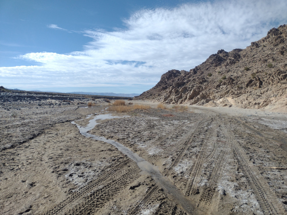
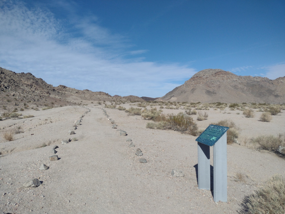
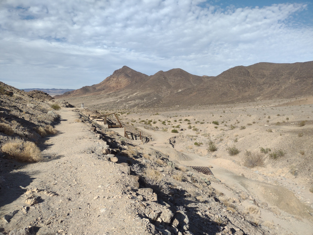
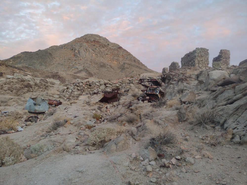
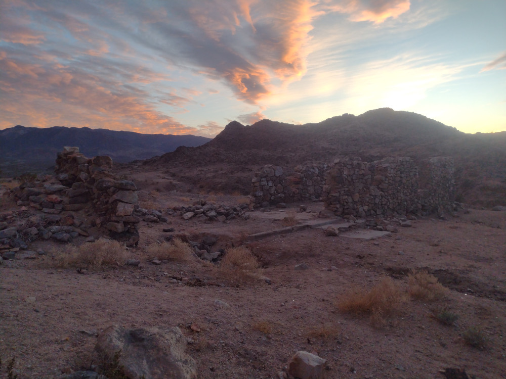
From US-395, I drove east on Fremont Peak Road. Some sections were smooth and fast, other parts were washboard slow. Somewhere around 35.19629419590779, -117.52994646089353 the road splits. Going left will take you to the dry lake beds. You want to go straight. From here, the summit should be obvious. I parked above the mine ruins and started my hike up. There is a gnarly 4×4 trail I followed until I picked up a light use trail. The very end was steep and loose. At the top was some sort of repeater installed in a pelican case, along with solar panels and an antenna. No markings on the case to indicate it’s operating frequency. Ham? GMRS? Does it even work anymore? I setup my station and worked 40M. As the sun was going down, so was I. Back at the truck I drank a beer watching the sunset, then headed to the dry lakes to camp for the night.
A good write up of the geology is here.
https://sotl.as/summits/Wmsty6/ND-231
Date:03/05/2025 | Summit:W6/ND-231 (Fremont Peak)
| Time | Callsign | Band | Mode | Notes |
|---|---|---|---|---|
| 01:53 | WU7H | 7MHz | CW | S57N R53N |
| 01:54 | WW7D | 7MHz | CW | S57N R41N |
| 01:55 | KD7DTS | 7MHz | CW | S58N R33N |
| 01:56 | NT6E | 7MHz | CW | S57N R55N |
| 01:57 | KX0Y | 7MHz | CW | S57N R33N |
| 01:58 | K9PM | 7MHz | CW | S55N R57N |
| 02:01 | N0IPA | 7MHz | CW | S55N R41N |
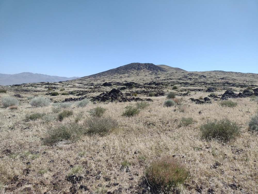
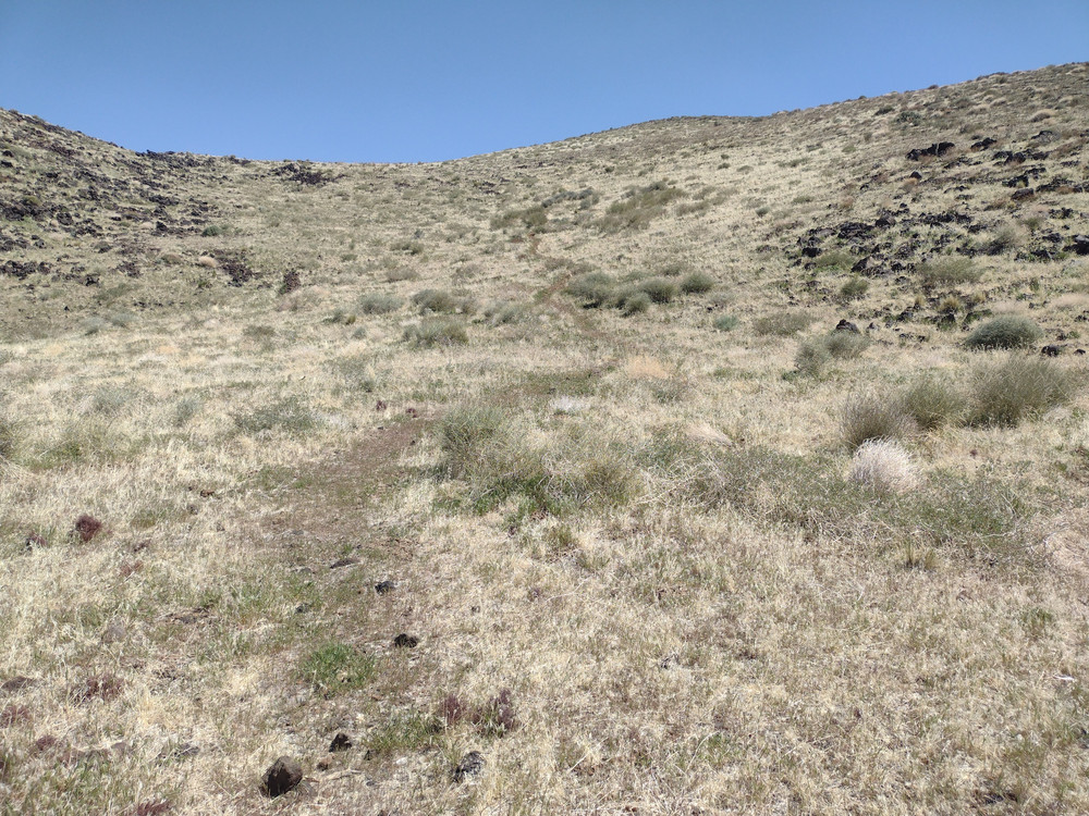
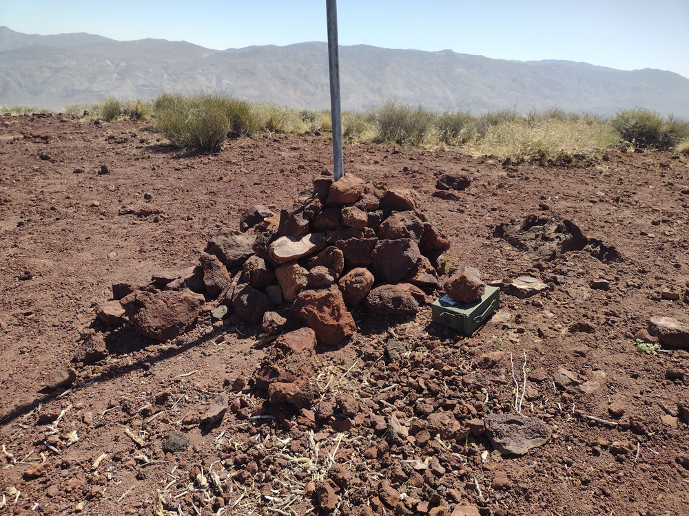
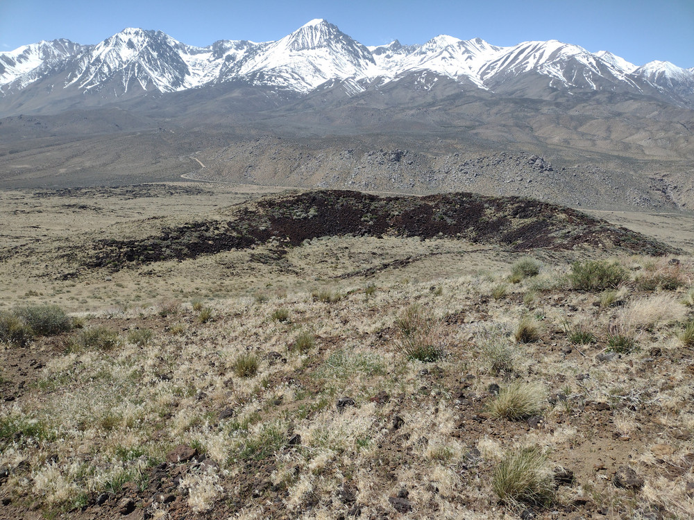
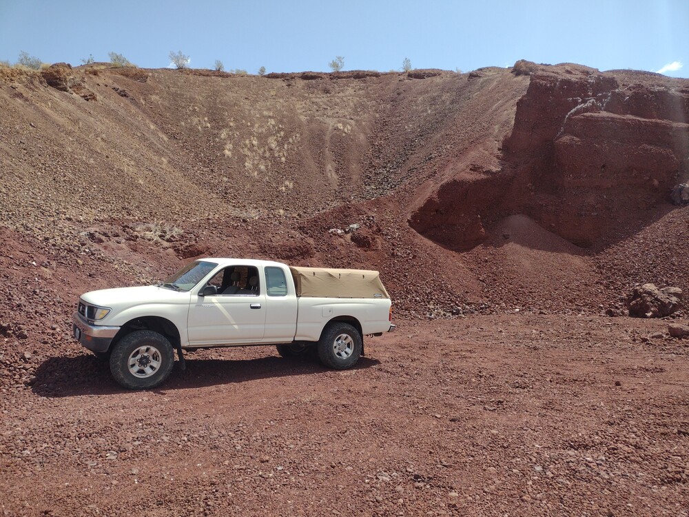
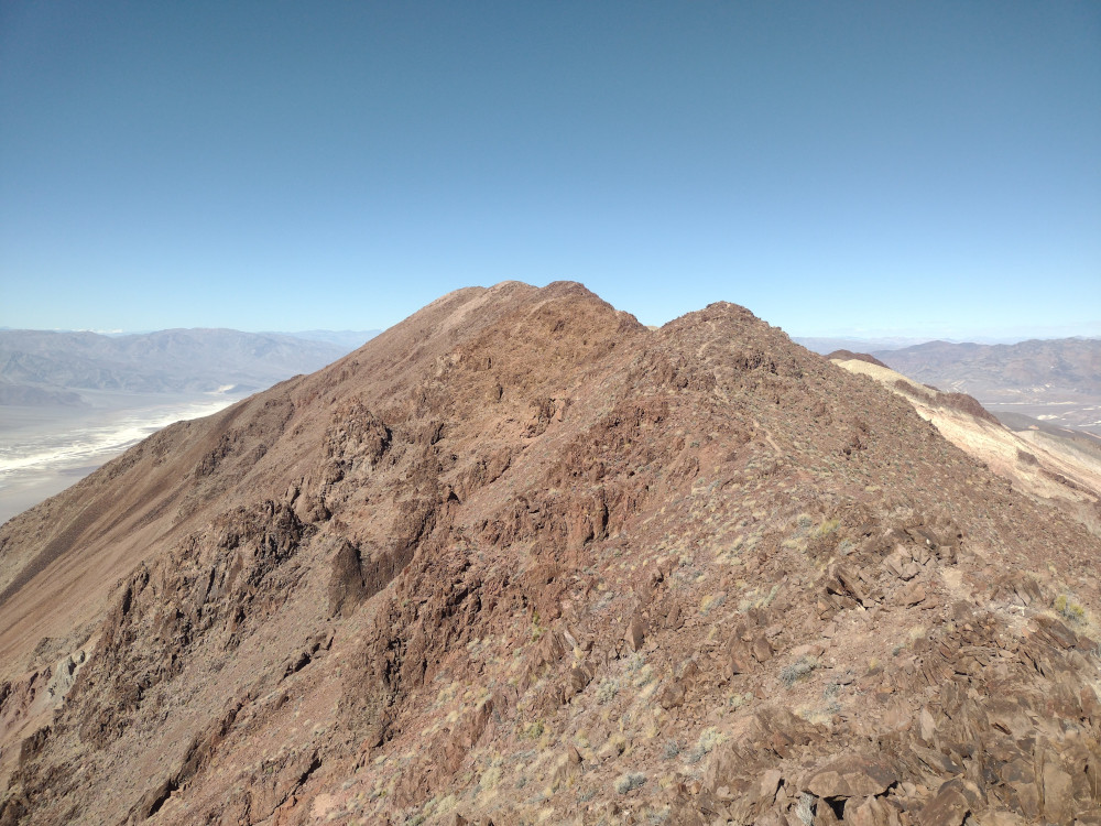
Crater Mountain is just to the west of Big Pine, CA. It’s easily accessible by a dirt road on the west side of the summit. I drove up to the high point on the road, parked on the side, and cross country hiked across the lava fields. There were grazing cattle everywhere. About half way up I picked up a use trail to the summit. At the top is a register and a pole to attach a mast to. On the day of my assent, the wind was brutal. My mast snapped in half, I couldn’t sign the register without the whole thing blowing away. You could do that thing where you lean far into the wind but not fall over. I found a a bit of shelter from the wind on the lee side of the summit. Used a KH1 with the whip antenna to make QSOs on 20M, and 17M, then headed down. The route back was close to my ascent, zing-zagging around the cows. Looking at a map later, I found that use trail I picked up leads to some lava tubes. Next time I’m out there I need to check those out.
https://sotl.as/summits/W6/IN-042
Date:18/04/2025 | Summit:W6/IN-042 (Crater Mountain)
| Time | Callsign | Band | Mode | Notes |
|---|---|---|---|---|
| 18:51 | AA7OY | 14MHz | CW | S2S W5N/AP-029 S57N R56N |
| 18:58 | WU7H | 14MHz | CW | S58N R42N |
| 19:00 | N1CLC | 14MHz | CW | S2S W5N/AP-029 S58N R57N |
| 19:01 | WW7D | 14MHz | CW | S58N R41N |
| 19:12 | AC7P | 18MHz | CW | S56N R53N |
| 19:13 | KF9D | 18MHz | CW | S53N R53N |
| 19:14 | WB8BHN | 18MHz | CW | S44N R33N |
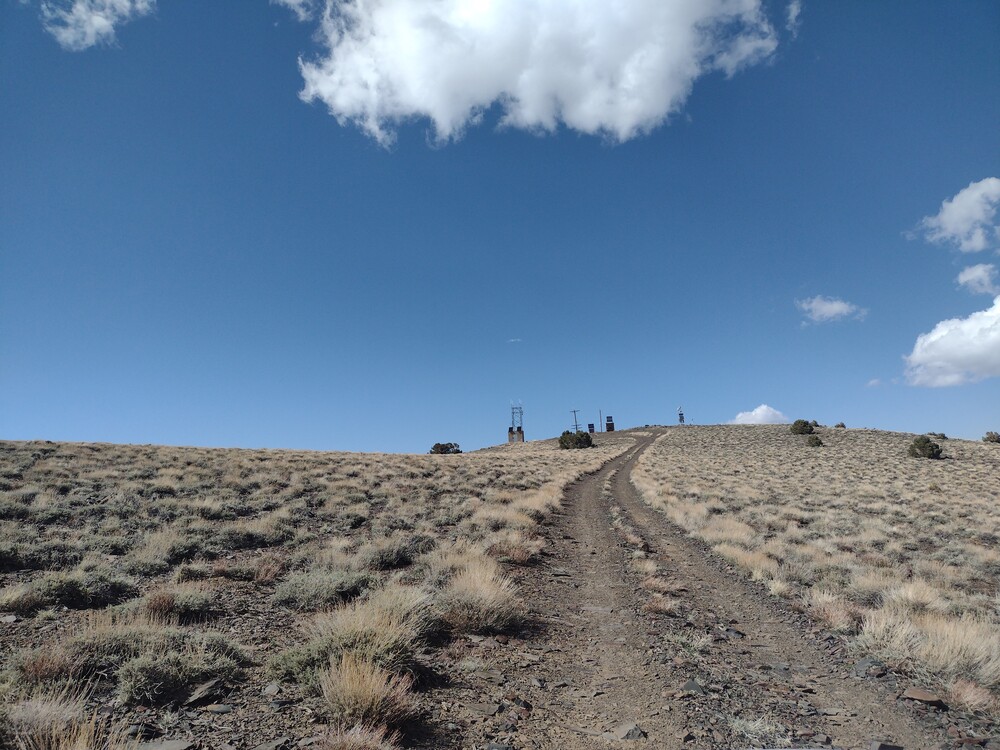
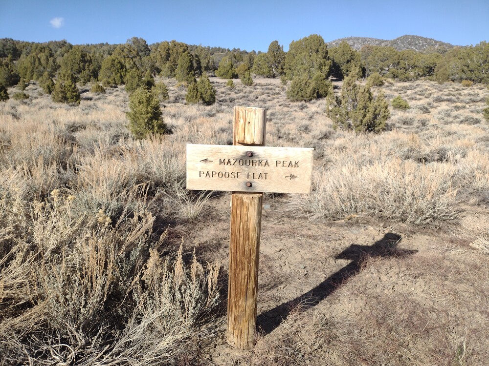
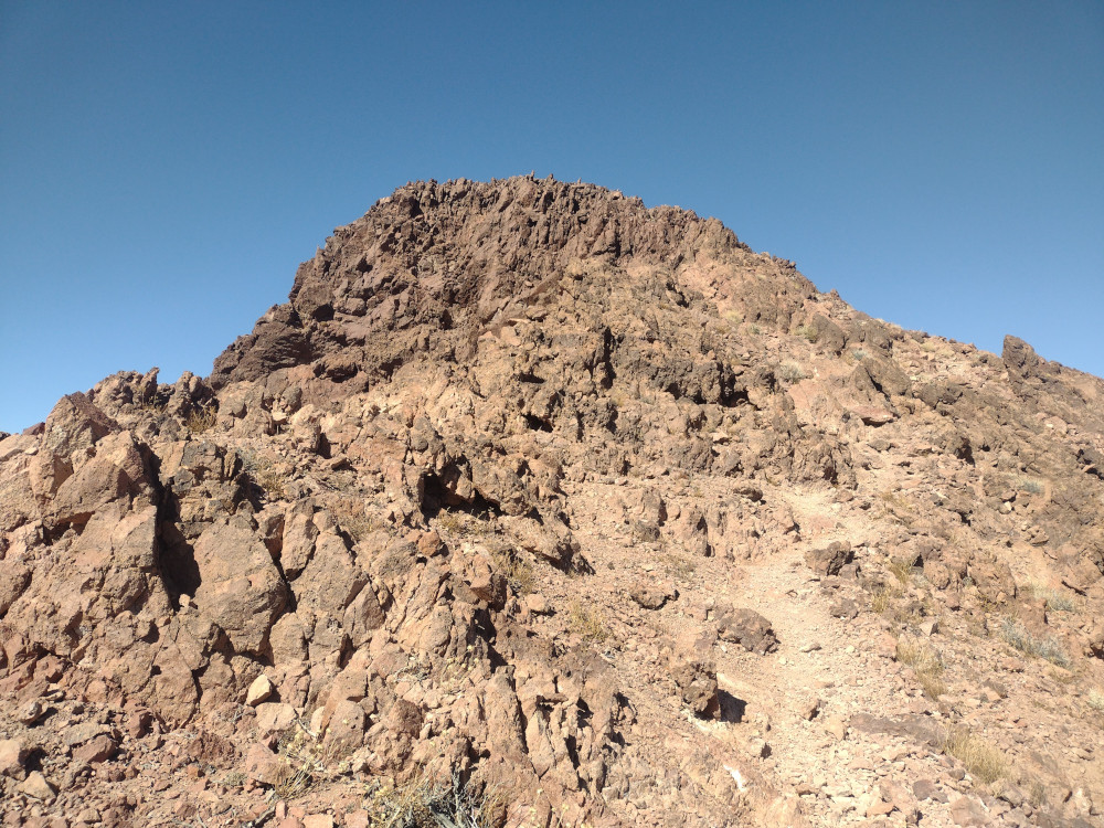
I’ve wanted to visit Mazourka Peak since I started SOTA, 5 years ago. The summit is a drive up from Independence on Hwy 395, take Mazourka Canyon Road from the south end of town all the way to the top. Took about 2 hours one way to drive the 22 miles up on the gravel road. At the top are some small radio shelters, and an amateur repeater. It was obnoxiously windy and cold, so my visit was short. I setup a Yaesu 817 with an EFHW antenna and worked 20M CW. One FM QSO to a ham in Bishop, CA. On the drive down I stopped several time to explore old mining ruins, and to scout another summit. I’ll be back up there again soon!
https://sotl.as/summits/W6/CD-005
Date:17/04/2025 | Summit:W6/CD-005 (Mazourka Peak)
| Time | Callsign | Band | Mode | Notes |
|---|---|---|---|---|
| 22:58 | K6MWK | 144MHz | FM | S59 R59 |
| 23:11 | VA7SGY | 14MHz | CW | S58N R55N POTA |
| 23:17 | NE7ET | 14MHz | CW | S56N R55N |
| 23:18 | K7SO | 14MHz | CW | S57N R53N |
| 23:20 | AB0BM | 14MHz | CW | S58N R33N |
| 23:23 | VA6DM | 14MHz | CW | S55N R55N |
| 23:23 | K7WFM | 14MHz | CW | S56N R56N |
| 23:31 | WW7D | 14MHz | CW | S2S W7W/PL-070 S22N R33N |
| 23:34 | WU7H | 14MHz | CW | S2S W7W/PL-070 S22N R33N |
If you have ever driven up to Mammoth Lakes from Los Angeles, you probably drove right past Red Hill. The hill is an ancient volcano, which is covered in small marble sized volcanic rock called cinders. The surrounding area features fields of basalt, with Fossil Falls just to the south of the summit. I parked my truck on the side of Red Hill, in an area where it appeared to be mined for it’s cinder. From there I started up. You can make out a use trail most of the way. The small, loose cinders made the trek up slow, as it felt like walking on a beach, except worse. Take a step, slide back a bit. Once at the top I used the KH1 with the whip. Worked 6 stations across two bands – two S2S. While packing up I found the summit register hidden in some rocks. I signed it and started heading down. Loose rocks make the decent quick, and I was back on the highway heading north quickly.
Date:17/04/2025 | Summit:W6/ND-283 (Red Hill)
| Time | Callsign | Band | Mode | Notes |
|---|---|---|---|---|
| 19:32 | WB8BHN | 21MHz | CW | S44N R41N |
| 19:33 | KF9D | 21MHz | CW | S56N R53N |
| 19:47 | WU7H | 14MHz | CW | S2S W7W/PL-063 S55N R51N |
| 19:49 | WW7D | 14MHz | CW | S2S W7W/PL-063 S55N R51N |
| 19:50 | N7UN | 14MHz | CW | S56N R33N |
| 19:52 | KT5X | 14MHz | CW | S599 R56N |

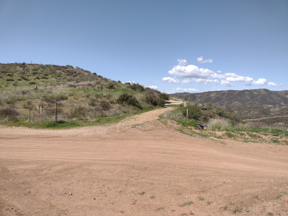
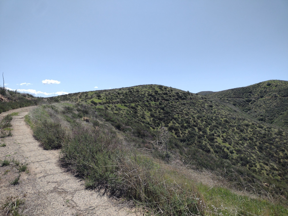
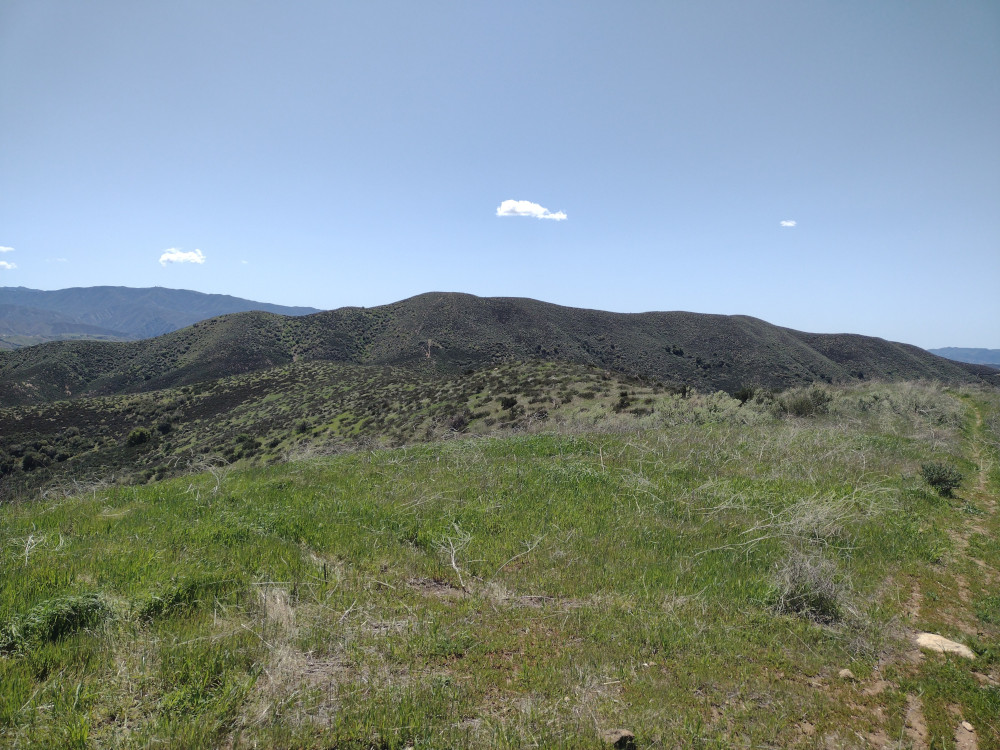
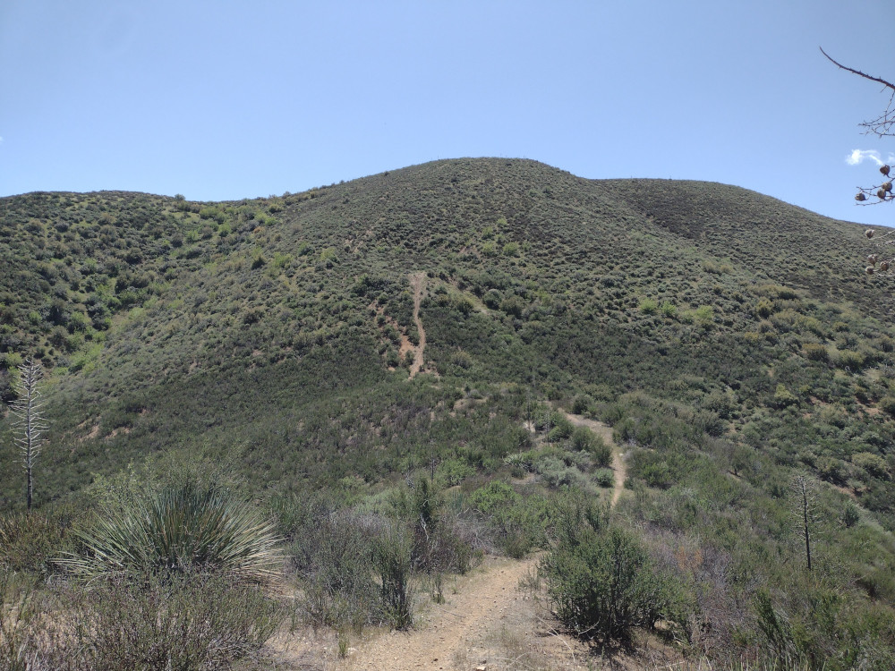
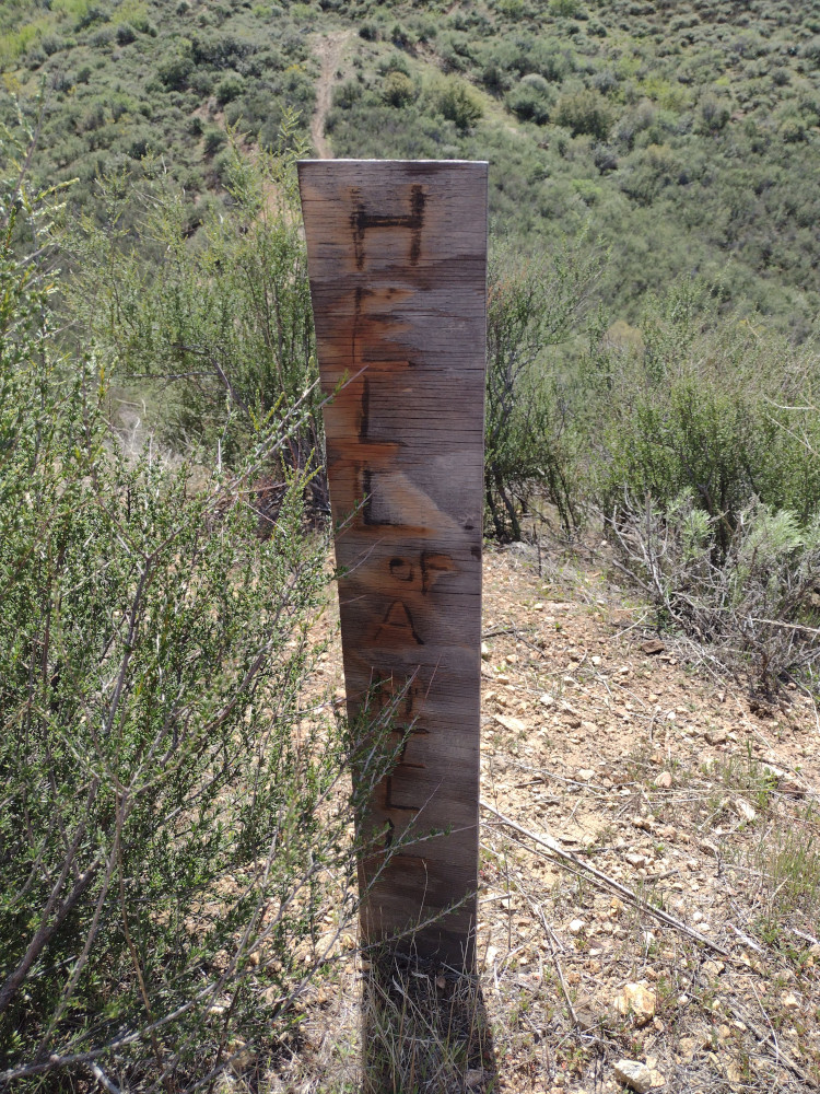
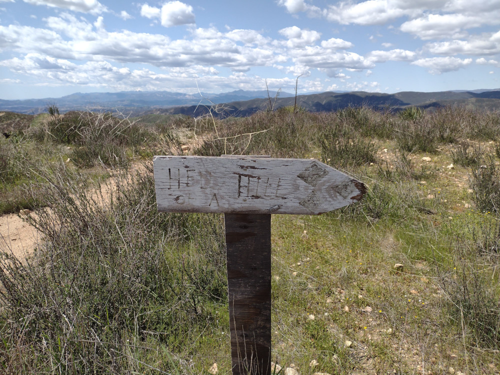
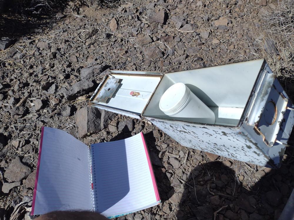
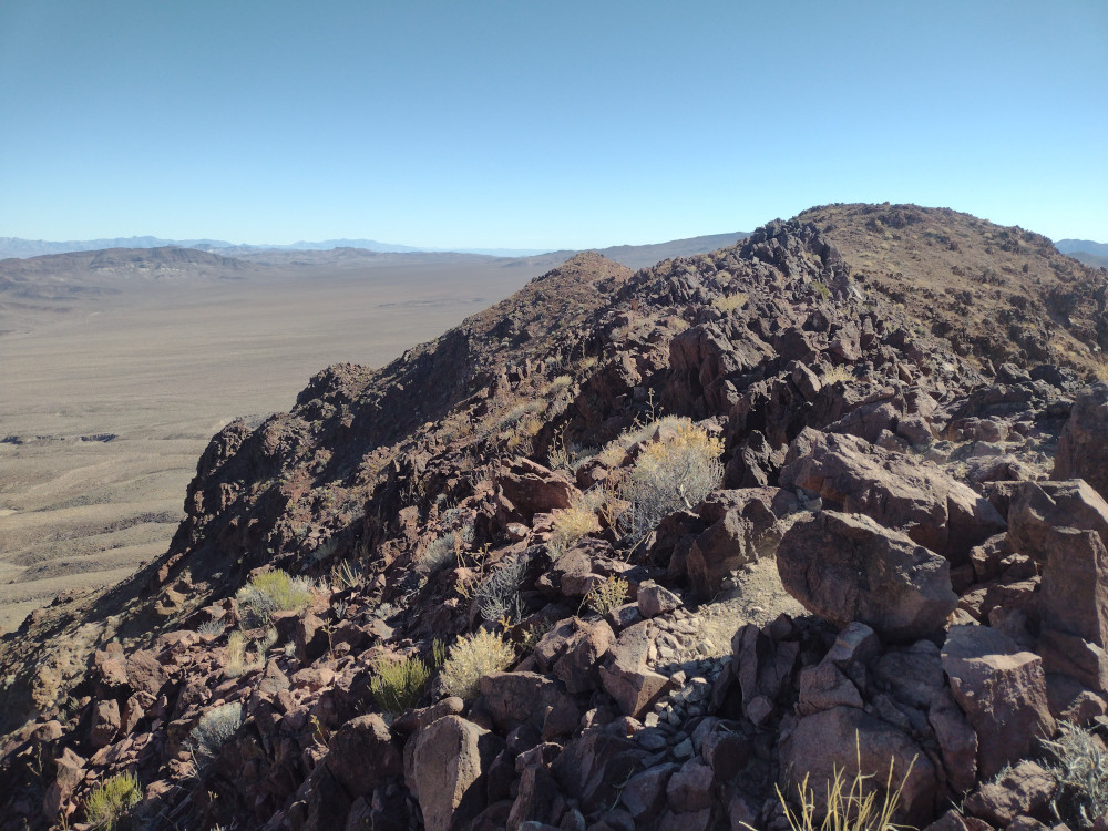
I’ve overlooked this summit for years because it was rarely activated and only worth two points. I got skunked twice on two earlier SOTA attempts due to closed roads. Frustrated, I pulled over to the side of the road and found the closest summit to me. That was Burn Benchmark. After some quick research, I headed into the OHV area, parked where other vehicles were parked and headed down the well used trail. I did not see any no trespassing signs anywhere along my route. The hike was mostly enjoyable, however it was very windy. About 2/3rds of the way there you see a very steep mountain; a small makeshift sign read “Hell Hill”. I’m assuming a dirt biker put it there as, there was evidence of dirt bikes in the area. As a guy who rides, I have no idea how you could wrangle a bike up something like this. Perhaps they went down? Their efforts left permanent scars on the hillside. Bummer.
https://sotl.as/summits/W6/CT-271
Date:04/04/2025 | Summit:W6/CT-271 (Burn Benchmark)
| Time | Callsign | Band | Mode | Notes |
|---|---|---|---|---|
| 20:14 | KT5X | 14MHz | CW | S58N R22N |
| 20:17 | AJ6KZ | 14MHz | CW | S2S W6/CT-116 S599 R53N |
| 20:19 | WW7D | 14MHz | CW | S2S W7W/KG-137 S33N R41N |
| 20:20 | K6HPX | 14MHz | CW | S58N R53N |
| 20:21 | W0KDM | 14MHz | CW | S56N R33N |
| 20:22 | N0RZ | 14MHz | CW | S44N R55N |
| 20:23 | N6ET | 14MHz | CW | S55N R53N |
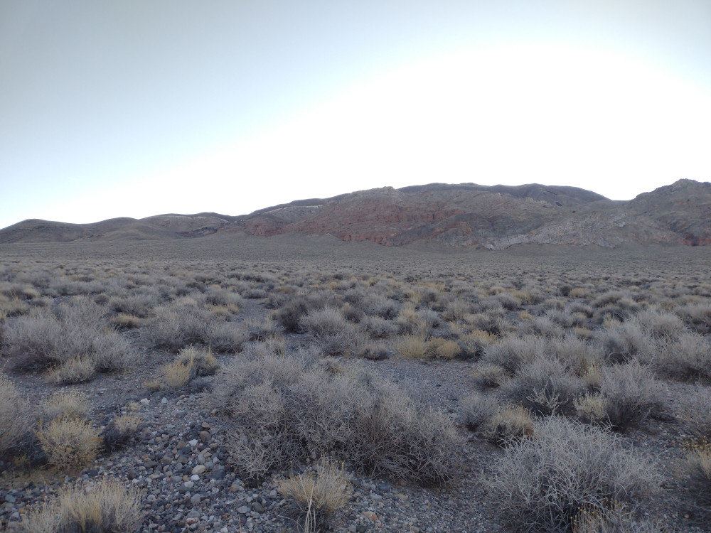
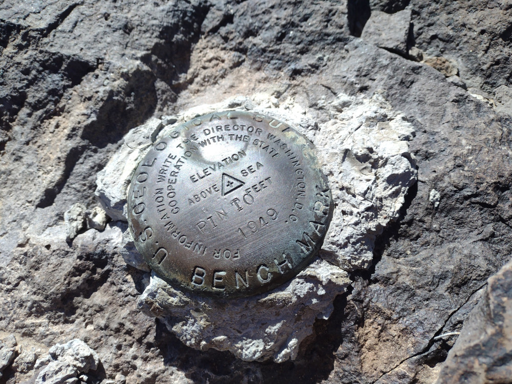
I woke up early at the big RV parking lot/ campsite in Stovepipe wells; not my favorite place to sleep but an easy option. I quickly made some coffee and headed up to Towne Pass to start my hike up to Pinto Peak. Once there and moving around I noted the temperature was 37F, the wind was blowing at an uncomfortable speed, and I was wearing shorts. The sun wasn’t over the horizon yet so I knew it would warm up at the day progressed. As I started the hike up the first climb, the sun peaked over the landscape directly in front of me, inhibiting my vision. This made route finding somewhat tricky. The majority of this hike is class 2, with some light class 3 sprinkled in.
After several wrong turns, I finally made it to the summit, where I found and signed the register. It was still very windy at the top, setting up my standard EFHW antenna would have been tricky, and perhaps result in a broken mast or wire. Luckily I brought a KH1. This radio has a small whip antenna and tuner built in. While not a great performer compared to full size aerials, it works in situations like this well. Huddled behind the rock cairn, out of the wind – I worked 15M, and 17M. No S2S unfortunately.
After the working all stations in the initial pileups, I signed QRT and headed back to the truck. I’d had enough of the strong winds and was feeling fatigued by it. I made good time heading down the hill but made several wrong turns off my initial track which slightly extended the trip. This also sent me down some class 3 spots which I could have possibly avoided. Back at Towne Pass, there was a guy in a 1st generation Toyota Tacoma refueling from portable jugs. He was pulling a large, 7,000 pound trailer. I chatted with him a bit and turns out the truck had the 2.7L engine, mated with an automatic transmission. Impressive.
https://sotl.as/summits/W6/ND-055
Date:21/02/2025 | Summit:W6/ND-055 (Pinto Peak)
| Time | Callsign | Band | Mode | Notes |
|---|---|---|---|---|
| 19:13 | W9MRH | 21MHz | CW | S53N R55N |
| 19:14 | W2WC | 21MHz | CW | S55N R599 |
| 19:15 | WW7D | 21MHz | CW | S599 R55N |
| 19:16 | W4JKC | 21MHz | CW | S57N R44N |
| 19:18 | NU7A | 21MHz | CW | S52N R53N |
| 19:19 | W5ODS | 21MHz | CW | S55N R55N |
| 19:21 | WU7H | 21MHz | CW | S57N R54N |
| 19:28 | AC7P | 18MHz | CW | S53N R22N |
| 19:30 | F4WBN | 18MHz | CW | S55N R599 |
| 19:32 | K7SO | 18MHz | CW | S58N R56N |
| 19:38 | WB7ULD | 18MHz | CW | S599 R51N |
| 19:41 | KF9D | 18MHz | CW | S57N R32N |
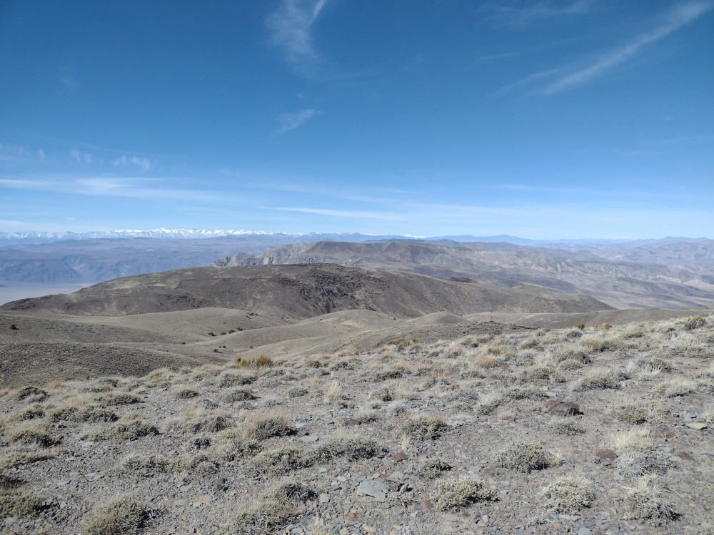
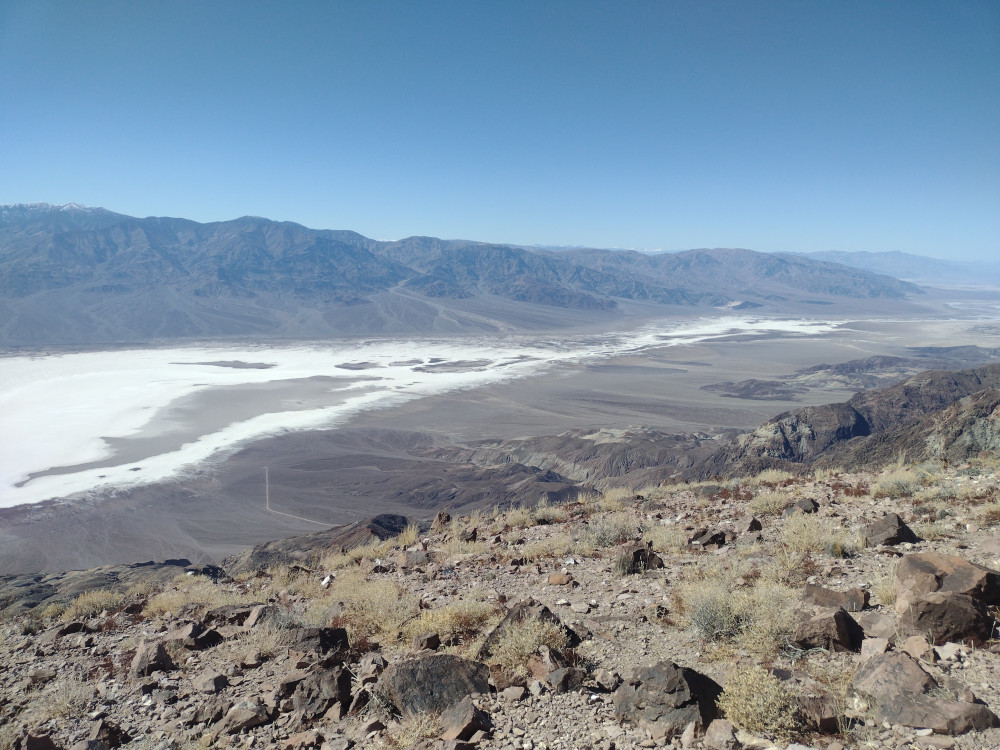
From Highway 190, take Dante’s View Road all the way to a large parking area. This is a pretty well known spot in Death Valley which offers stunning views of Badwater Basin and the Panamint Range. The summit of Dante Benchmark is just a short hike north of the parking area, and beyond that, Mount Perry, a little over 4 miles away on a well worn trail.
Like most of my hikes, I got up to the trailhead later than I would have liked. From there I wasted no time getting on the trail and away from the tourists on the pavement. It only takes about 5 minutes (or less) to get to the first summit, but my plan was to activate the furthest one first. The trail to Mount Perry is easy to follow, but you loose about 1,000 feet of elevation on the way there, before climbing another 1,000 feet back up. Near the summit the trail is a bit of a scramble. See .gpx file below. Once at the top I had the whole mountain to myself. I setup an EFHW and worked 15M and 7M CW, no S2S. After exhausting the initial round of chasers I packed up and headed back to Dante Benchmark.
https://sotl.as/summitRidges/W6/ND-142
Date:20/02/2025 | Summit:W6/ND-142 (Mount Perry)
| Time | Callsign | Band | Mode | Notes |
|---|---|---|---|---|
| 20:47 | WB6POT | 7MHz | CW | S57N R57N |
| 20:48 | KN6DMO | 7MHz | CW | S57N R55N |
| 20:49 | W6LEN | 7MHz | CW | S58N R599 |
| 20:50 | K6HPX | 7MHz | CW | S57N R54N |
| 20:51 | K1CT | 7MHz | CW | S58N R52N |
| 20:52 | AE7I | 7MHz | CW | S57N R57N |
| 20:52 | W6TDX | 7MHz | CW | S55N R54N |
| 20:54 | WB7ULD | 7MHz | CW | S57N R53N |
| 21:05 | WW7D | 21MHz | CW | S58N R56N |
| 21:05 | W0MNA | 21MHz | CW | S57N R57N |
| 21:06 | W0ERI | 21MHz | CW | S57N R57N |
| 21:08 | NU7A | 21MHz | CW | S55N R55N |
| 21:08 | N7ITU | 21MHz | CW | S57N R57N |
| 21:09 | 7N1FRE | 21MHz | CW | S55N R41N |
| 21:10 | AK5SD | 21MHz | CW | S58N R55N |
| 21:12 | WU7H | 21MHz | CW | S58N R55N |
| 21:12 | W9UUM | 21MHz | CW | S57N R53N |
| 21:14 | N4EX | 21MHz | CW | S55N R53N |
I made it back to Dante Benchmark 30-ish minutes before UTC turnover and was feeling pretty scorched from wind and sun exposure. I was also pretty hungry. Not wanting to setup a full sized antenna, I found a nice rock near the top to sit on, and used a KH1 with the internal whip to make contacts on 17M CW. By the time I was getting back to the truck the sun was setting and the cold desert temperatures were creeping in.
https://sotl.as/summits/W6/ND-144
Date:20/02/2025 | Summit:W6/ND-144 (Dante Benchmark)
| Time | Callsign | Band | Mode | Notes |
|---|---|---|---|---|
| 23:35 | WW7D | 18MHz | CW | S599 R56N |
| 23:35 | N4DSH | 18MHz | CW | S53N R44N |
| 23:36 | W1UL | 18MHz | CW | S55N R55N |
| 23:37 | WU7H | 18MHz | CW | S53N R53N |
| 23:38 | W0MNA | 18MHz | CW | S57N R56N |
| 23:38 | W0ERI | 18MHz | CW | S57N R57N |
| 23:40 | JG0AWE | 18MHz | CW | S22N R22N |
| 23:40 | NU7A | 18MHz | CW | S55N R33N |
| 23:41 | W5GDW | 18MHz | CW | S56N R44N |
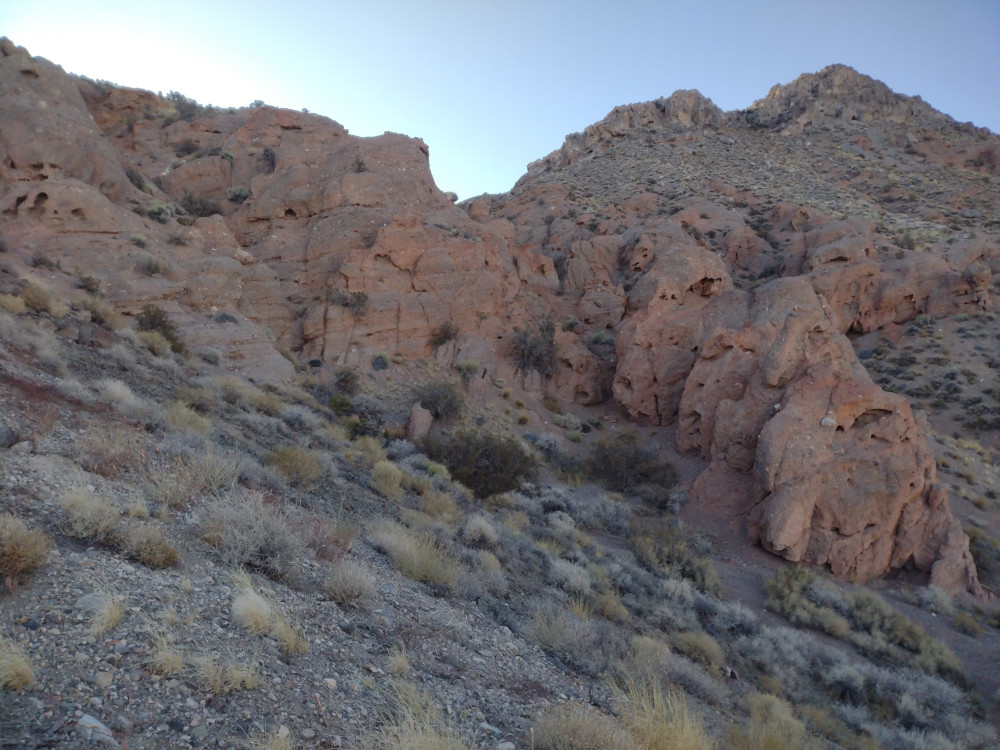
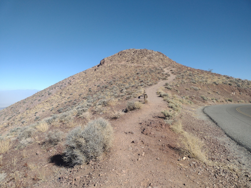
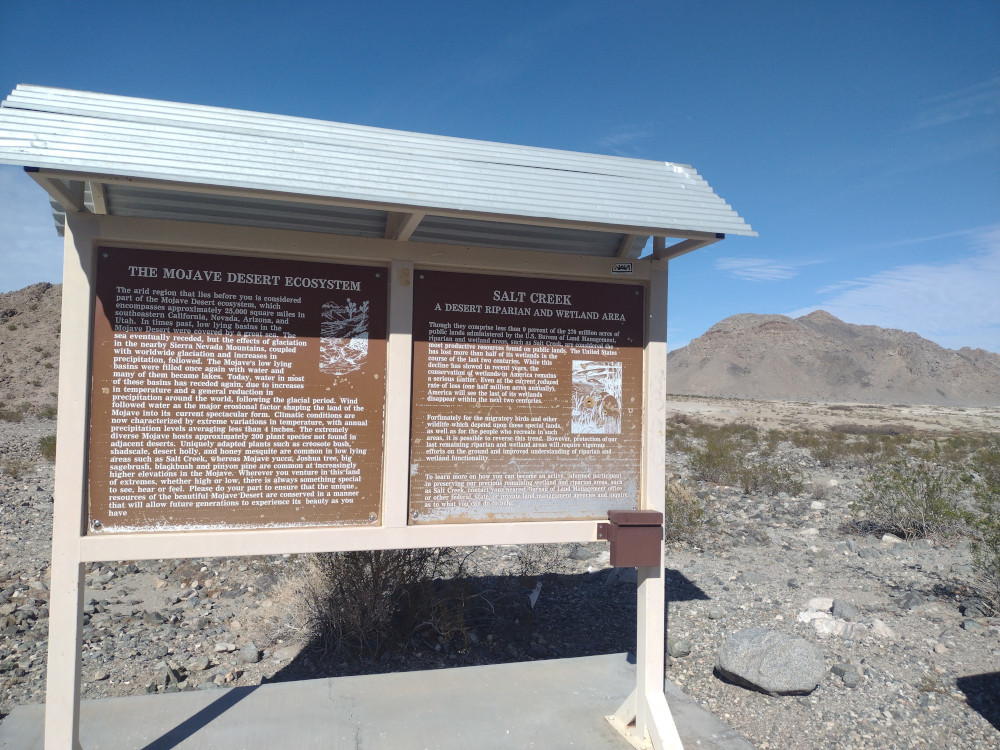
The trailhead for Salt Benchmark was right off CA-127 on the way to Death Valley National Park. Once there I was surprised to find a wetland area named Salt Creek, complete with a bit of flowing water. Additionally, there is a nice trail leading to some mining ruins, complete with information signs along the way describing the history of the area. This is honestly worth doing even if you don’t hike up to the summit. After checking out an old stamp mill, I started my way up to the summit on a narrow use trail. This is where most if the elevation gain starts. About half way up, it gets even steeper, and the rocks are razor sharp. I never considered hiking with gloves, but they would be very useful here. You you slip here, you will bleed. I got to the top just after 00:0 UTC and setup an end fed half wave connected to my new MTR 3B V4. Worked 15 and 20M, signed the register, and headed down because I was loosing daylight. By the time I got back to the truck it was dark. I ate a snack and headed to my camping spot in DVNP, Hole in the Wall, where it was extremely windy.
https://sotl.as/summits/W6/ND-376
Date:20/02/2025 | Summit:W6/ND-376 (Salt Benchmark)
| Time | Callsign | Band | Mode | Notes |
|---|---|---|---|---|
| 00:16 | JG0AWE | 21MHz | CW | S22N R32N |
| 00:16 | WU7H | 21MHz | CW | S57N R53N |
| 00:19 | JH1MXV | 21MHz | CW | S21N R31N |
| 00:28 | K2LT | 14MHz | CW | S55N R42N |
| 00:30 | KY4TWO | 14MHz | CW | S57N R57N |
| 00:31 | K2MO | 14MHz | CW | S57N R55N |
| 00:31 | K7SO | 14MHz | CW | S58N R56N |
| 00:32 | WB7BWZ | 14MHz | CW | S58N R54N |
| 00:33 | WW7D | 14MHz | CW | S57N R54N |
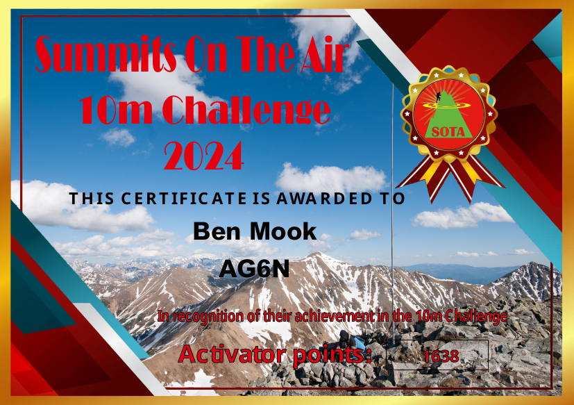
Last year I started bringing my Yaesu 817 up to more summits. Since this radio has the 10M band, and setting up a 10M antenna is easy, I worked a bunch of 10M. I was aware of this SOTA challenge, but wasn’t actively trying to get points. I ended up 22nd in W6, and 257th worldwide. Pretty good!