W6/SD-396 – Mine Benchmark

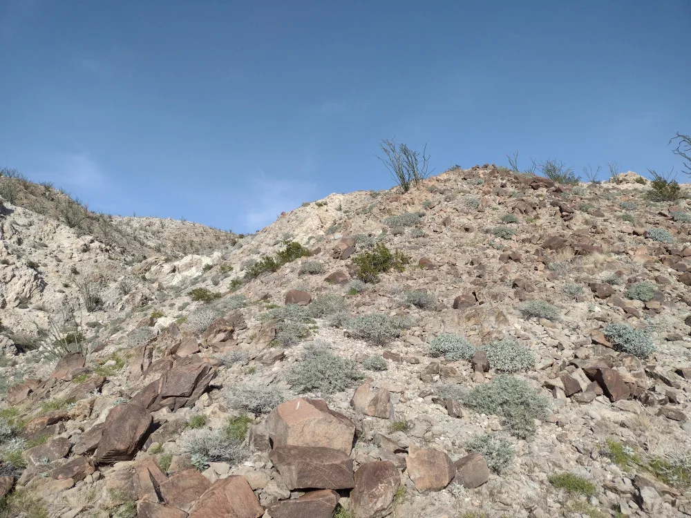
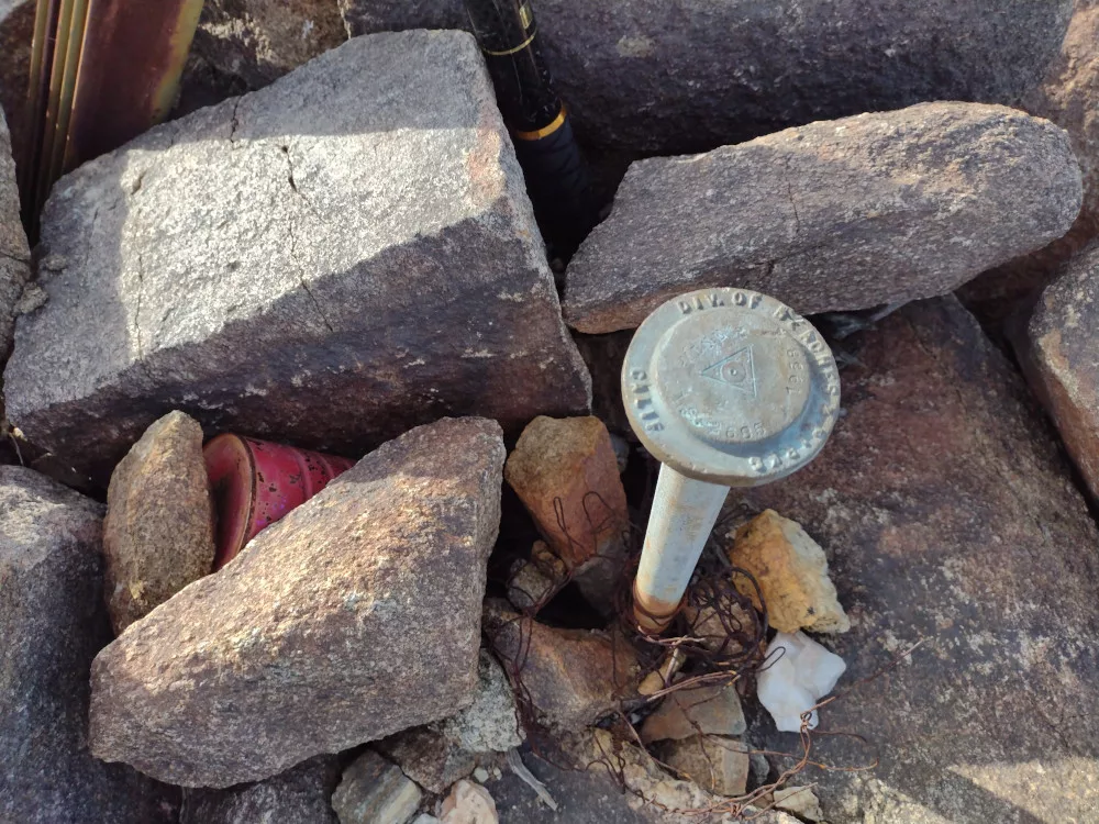
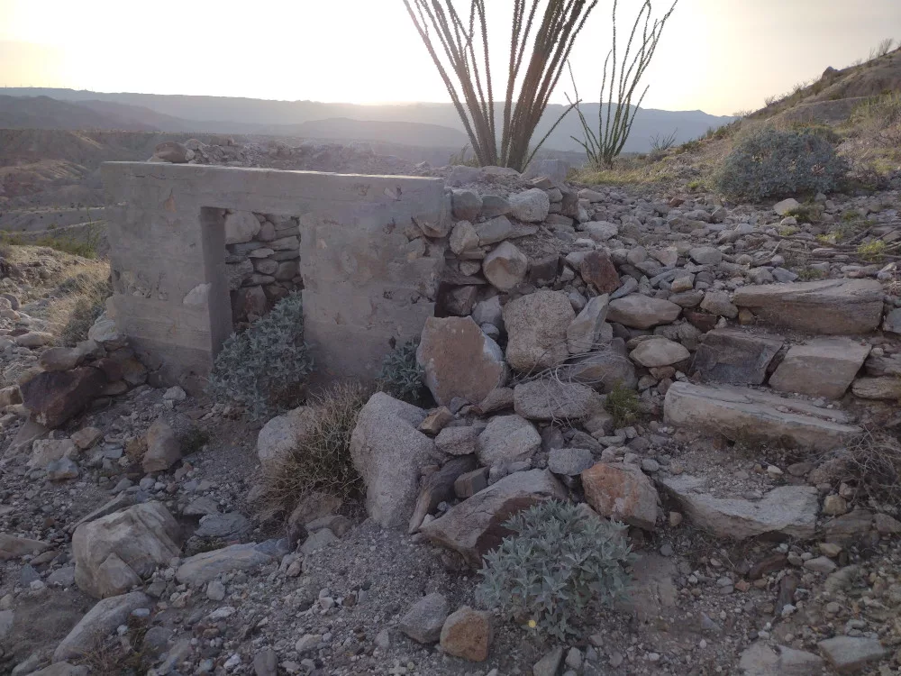
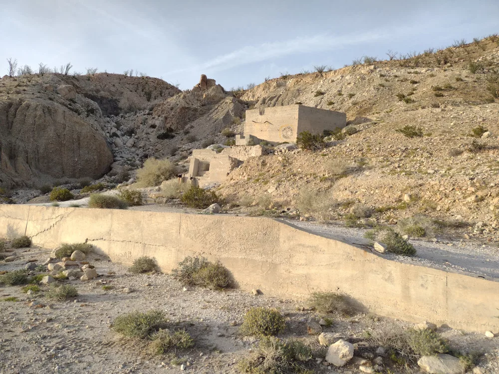
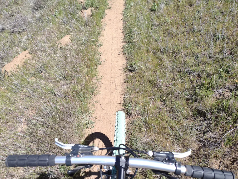
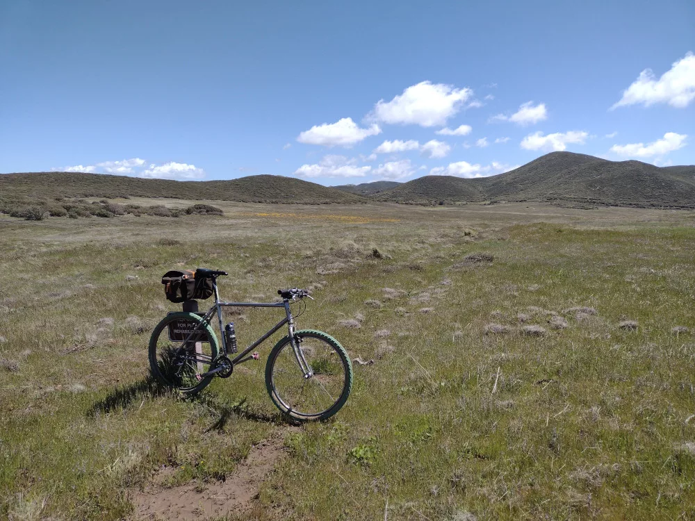
This was the third and last SOTA activation over a weekend trip to Anza-Borrego. It was later in the day and I needed to pick up my bike-packing pals in a few hours not too far from this summit so I had to make it a quick one. I parked the Jeep off the main road to the mine ruins, just before an area where the road was washed out, then hiked. I followed an old service road that went to the top of the mine ruins, then a sketchy scramble up a steep embankment to continue on. I’m glad I had some tracks to follow, as there are several ridges one could follow that dead-end; one could get somewhat lost up there. After a spirited walk to the top, I signed the register and waited for 00:00 UTC to start my activation. I stretched out my EFHW antenna and connected it to an MTR4B, first working 40M, then 20M. I got a text from the bike packing group with an ETA for their pickup so I packed up and headed down the hill the same way I came. The sketchy part was worse coming down, but overall it was a pretty easy hike, and perhaps my favorite of the weekend. After picking up the bike packing group, we went to Agua Caliente County Park for a dip in their excellent hot spring pool.

https://sotl.as/summits/W6/SD-396

Total distance: 2.58 mi
Max elevation: 1869 ft
Total climbing: 877 ft
Total time: 02:12:24
Download file: W6_SD_396_Mine_Benchmark.gpx

Date:10/03/2024 |  Summit:W6/SD-396 (Mine Benchmark) 

TimeCallsignBandModeNotes
00:05K6CPR7MHzCWS55N R52N
00:11N9OSW14MHzCWS33N R55N
00:15N6MTB14MHzCWS21N R33N S2S W6/SC-454
00:17KJ7DT14MHzCWS55N R55N
00:18WB7BWZ14MHzCWS57N R57N
00:19WW7D14MHzCWS57N R54N
00:22WB7HMA14MHzCWS55N R44N
00:23AK4JA14MHzCWS54N R55N

W6/SD-074 – Chariot Mountain

Chariot Mountain was the second of two summits I completed while camping at Cuyamaca Rancho State Park with the So. Cal SOTA group. Before the event N6MTB published a route from camp to the summit of Chariot. At that point my mind was made up, this is what I was going to do. After a quick breakfast, I jumped on the bike and headed up the mountain.

The ride was awesome, starting with some single track right at the camp, then into more single track through a meadow, to a fire road, to more single track through another meadow. Oh, weather was perfect too! Near the end of the fun stuff there is a big downhill over a fire road which leads to the bottom of Chariot. This wasn’t going to be fun climbing up! Once at the bottom, I realized there isn’t a trail up to the top! The summit is also guarded by thick pokey bushes. I stashed my bike, gathered my stuff and started the painful bushwhack to the top.

Since I didn’t have a backpack, I was hand carrying everything I couldn’t fit onto my pockets. Unfortunately, my Yaesu HT was clipped to my pocket and disappeared somewhere in the brush. I was never going to find it. After attempting to backtrack my exact route for 15 minutes or so, I heard a radios squelch crack open – Ara was on a summit, and I was able to locate my radio about 30 feet away from where I was standing. I would have never found it otherwise!

I now had to backtrack through the brush again. My skin was starting to feel ‘raw’ from all the scratches. I wasn’t having a good time. Fortunately, the higher you go, the thinner the brush, and near the top, there isn’t any brush! Once on the actual summit, I signed the register and pulled out my KH1 with the whip. Worked 15, 17, and 20M, then 2M FM. After exhausting all the chasers I started my decent through the brush once again.

Back at the road it took me a minute to find my bike and pack all my stuff up for the ride back to camp. That big uphill wasn’t so bad and before I knew it I was back riding through the various meadows on single track. I chose not to take the exact route back, which was rad because I ran into Bill and Drew on the main road and rode with them back to camp on a different trail. What a rad day!

https://sotl.as/summits/W6/SD-074

Total distance: 22.61 mi
Max elevation: 4946 ft
Total climbing: 2584 ft
Total time: 06:18:17
Download file: W6_SD_074.gpx

Date:27/04/2024 |  Summit:W6/SD-074 (Chariot Mountain) 

TimeCallsignBandModeNotes
19:15K6ARK144MHzFMS59 R59
19:16KD7DTS144MHzFMS59 R59
19:17WO6JO144MHzFMS59 R59 S2S W6/CC-014
19:18N6AN144MHzFMS59 R59 S2S W6/CC-014
19:18KX6I144MHzFMS59 R59 S2S W6/CC-014
19:19KI6SLA144MHzFMS59 R59
19:20N6XZN144MHzFMS59 R59
19:35W9SSN21MHzCWS57N R599 S2S W6/CC-014
19:37WD4CFN21MHzCWS51N R44N
19:38W7TMD21MHzCWS57N R599
19:42N7KRN21MHzCWS52N R53N
19:44KC1NDQ21MHzCWS52N R33N
19:48KI5JG18MHzCWS52N R55N
19:50WU7H18MHzCWS52N R53N S2S W7W/CH-241
19:52WW7D18MHzCWS52N R51N S2S W7W/CH-241
19:53NU7A18MHzCWS57N R33N
20:00N1SMB14MHzCWS42N R55N S2S W6/SC-335
20:03W6LOR14MHzCWS53N R52N S2S W6/CT-268
Stashed my bike here
Back at camp, that’s Buck, Bill, and myself.

W6/CC-014 – Cuyamaca Peak

Cuyamaca Peak is one of two summits I completed while camping at Cuyamaca Rancho State Park with the So. Cal SOTA group. I rode my mountain bike up the steep paved road from the campground and ended up operating in a gravel parking area near the tower facility. There was thick fog, with water accumulating on the infrastructure above. Whenever the wind blew, it would feel like it was raining, and perhaps it was a bit. It was starting to get late by the time I got up there, so I worked 20M CW, then 2M FM which got me most of the camping group in 3 minutes. I took a different way down to make a loop out of the ride, but I think I would go up this way next time as it was a nicer experience.

https://sotl.as/summits/W6/CC-014

Total distance: 6.02 mi
Max elevation: 6479 ft
Total climbing: 1573 ft
Total time: 02:08:57
Download file: W6_CC_014.gpx

Date:27/04/2024 |  Summit:W6/CC-014 (Cuyamaca Peak) 

TimeCallsignBandModeNotes
01:00WW7D14MHzCWS58N R51N
01:01N7KRN14MHzCWS55N R55N
01:03W2MHS14MHzCWS51N R22N
01:09N4DH14MHzCWS51N R44N
01:13N6XZN144MHzFMS59 R59
01:13K6ARK144MHzFMS59 R59
01:13W9SSN144MHzFMS59 R59
01:14N6MTB144MHzFMS59 R59
01:14KB9ENS144MHzFMS59 R59
01:14KD7DTS144MHzFMS59 R59
01:14K6RWZ144MHzFMS59 R59
01:15KI6SLA144MHzFMS59 R59
01:15WB6EDK144MHzFMS59 R59
01:15K6CWC144MHzFMS59 R59
01:15WO6JO144MHzFMS59 R59
01:18KK6WLD144MHzFMS55 R31
Paved road up
Foggy!
Trail down, quite boggy in some places