This is a fun 8 point SOTA hike, which is around 5 miles round trip. Note: If you’re looking at a map, the actual summit is past Mount Williamson; keep going and follow Pleasant View Ridge to a peak named 8248. If you keep going even further, you will run into Pallet Mountain, the site of a C-119 aircraft crash.
https://sotl.as/summits/W6/CT-247
Total distance: 4.82 mi
Total climbing: 2115 ft
Download file: MtWilliamson.GPX
Total climbing: 2115 ft
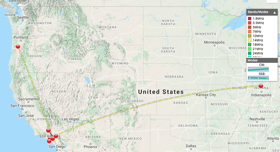
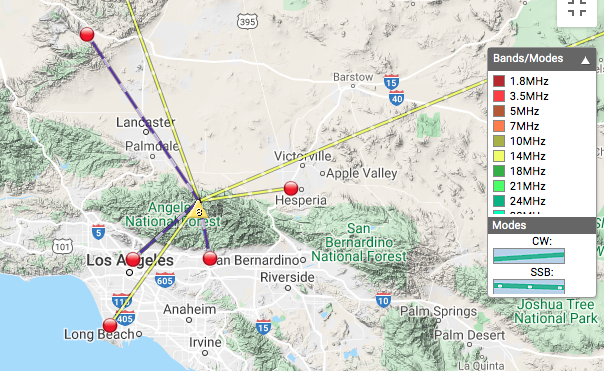
Date:31/07/2020 | Summit:W6/CT-247 (Mount Williamson)
| Time | Callsign | Band | Mode | Notes |
|---|---|---|---|---|
| 20:17 | WWD7 | 28MHz | SSB | 55 55 |
| 20:18 | K6WLD | 28MHz | SSB | 59 59 |
| 20:30 | KI6PMD | 28MHz | SSB | 59 59 |
| 20:50 | W7HO | 14MHz | SSB | 59 56 |
| 20:50 | KB6AE | 14MHz | SSB | 59 52 |
| 20:52 | N9XG | 14MHz | SSB | 49 54 |
| 20:59 | N6JZT | 14MHz | SSB | 55 43 |
| 21:21 | N1WAX | 144MHz | FM | 59 59 |
| 21:25 | KM6CEM | 144MHz | FM | 59 33 |
| 21:26 | AJ6N | 144MHz | FM | 59 53 |
| 21:28 | WB6FQZ | 144MHz | FM | 59 55 |
| 21:29 | KI6PMD | 144MHz | FM | 59 42 |
| 21:31 | KM6SVN | 144MHz | FM | 59 51 |