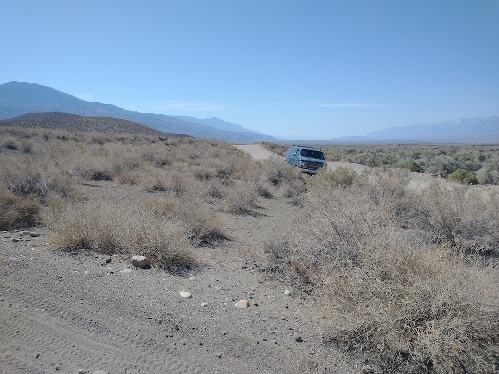
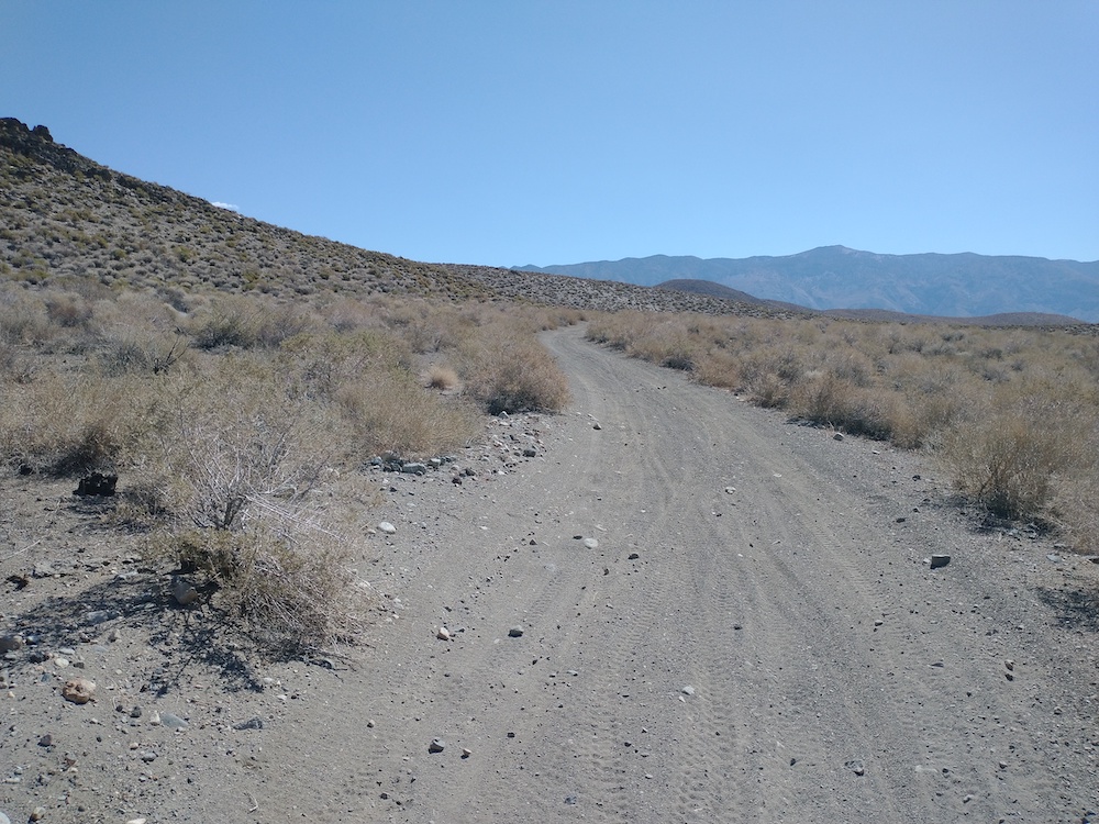
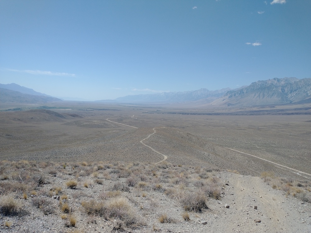
On the way home from several activations in the White Mountains and the Inyo National Forest outside Mammoth Lakes, I decided to bag one last peak along Hwy 395. I started this hike just off Tinemaha Road. The map I was referencing listed a mine at the bottom of the trail but I didn’t see much evidence of that. It was later in the day and very hot; I sucked down a bit over a liter of water in the mile or so to the top. I used about half of my other liter to dump on my head to cool down. At the top, a small rock pile was used to support my vertical antenna. I worked 20 SSB, 40M SSB (which got no contacts) and 30M CW, two S2S there. This summit has outstanding views of the Owens Valley, and I hope to activate this one again soon.
https://sotl.as/summits/W6/IN-050
Max elevation: 4950 ft
Total climbing: 713 ft
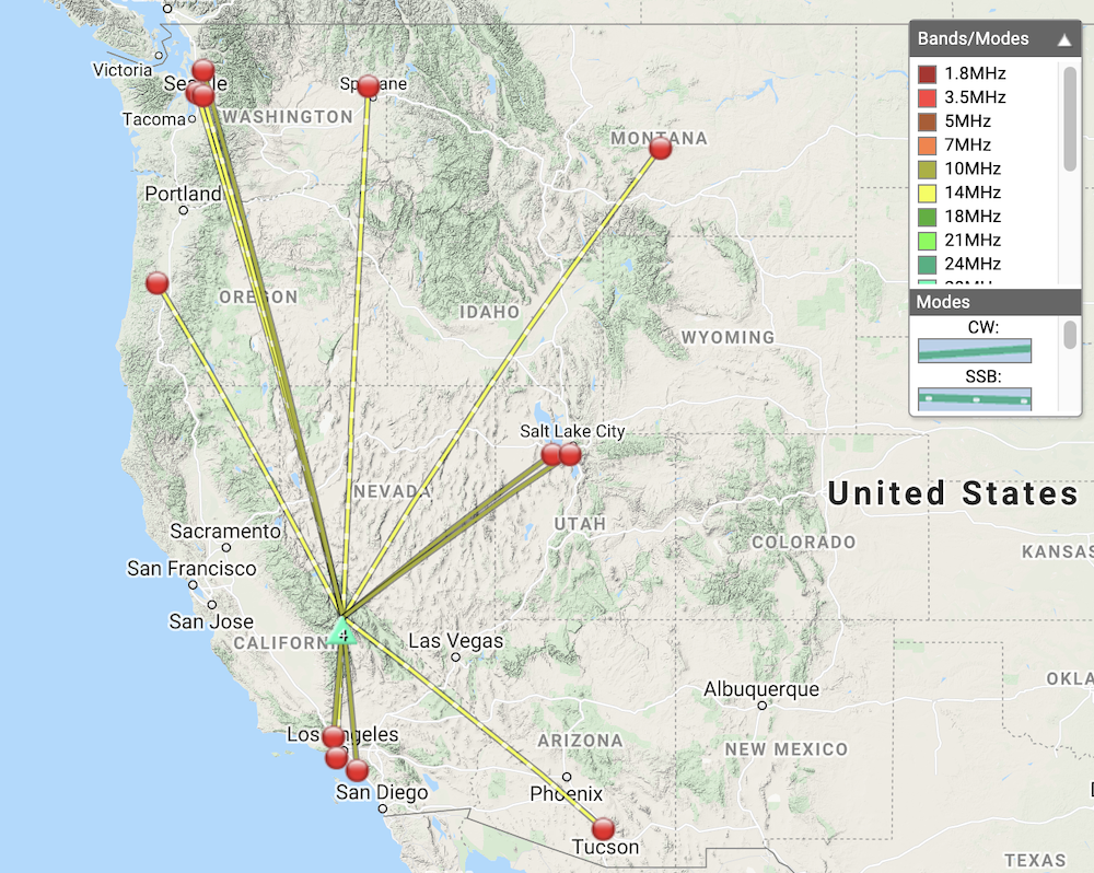
Date:08/07/2021 | Summit:W6/IN-050 (Poverty Hills)
| Time | Callsign | Band | Mode | Notes |
|---|---|---|---|---|
| 17:58 | K6HPX | 14MHz | SSB | S59 R51 |
| 17:59 | NS7P | 14MHz | SSB | S59 R57 |
| 17:59 | WU7H | 14MHz | SSB | S59 R55 |
| 18:00 | KD7DTS | 14MHz | SSB | S59 R33 |
| 18:02 | N6KJH | 14MHz | SSB | S56 R33 JEFF |
| 18:03 | N0WAE | 14MHz | SSB | S59 R55 |
| 18:03 | WW7D | 14MHz | SSB | S57 R55 |
| 18:04 | K6MW | 14MHz | SSB | S57 R55 |
| 18:11 | N7CNH | 10MHz | CW | S55N R55N S2S W7O/CE-051 |
| 18:20 | KA7GPP | 10MHz | CW | S599 R559 S2S W7W/CH-195 |
| 18:21 | WA6KYR | 10MHz | CW | S5NN R44N |
| 18:23 | WY7N | 10MHz | CW | S599 R559 |
| 18:26 | WB7ULD | 10MHz | CW | S59N R55N |
| 18:30 | KX6A | 10MHz | CW | S599 R55N |