2026 SoCal Winter SOTA Fest schedule –
1st –> https://blog.benmook.com/w6-sd-080-4633/
2nd –> (This one) https://blog.benmook.com/w6-sd-013-east-ord-mountain/
3rd –> https://blog.benmook.com/w6-sd-010-ord-mountain/
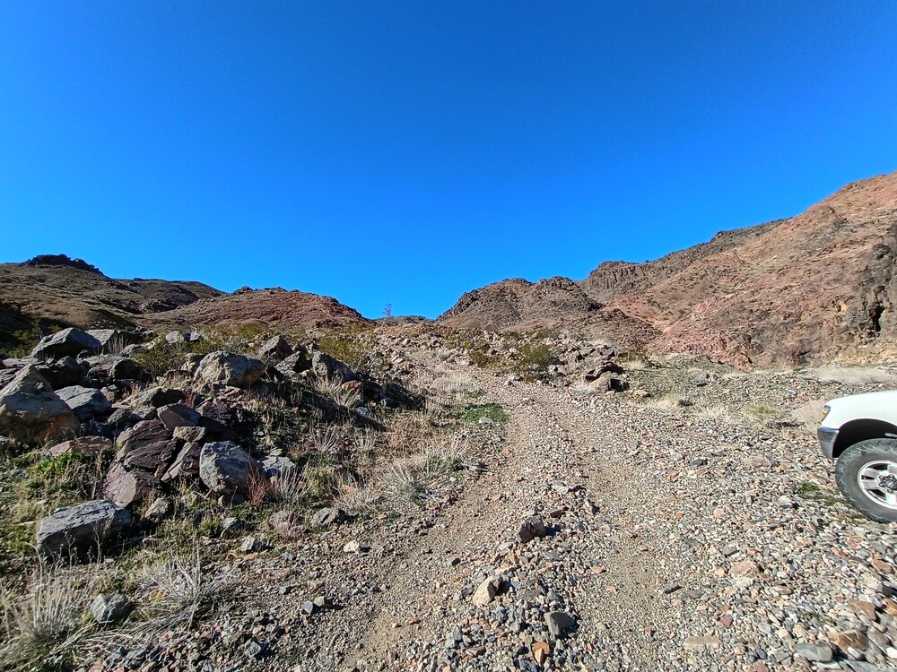
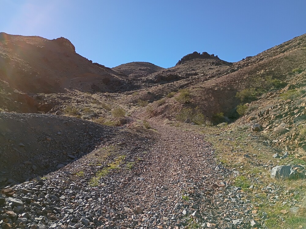
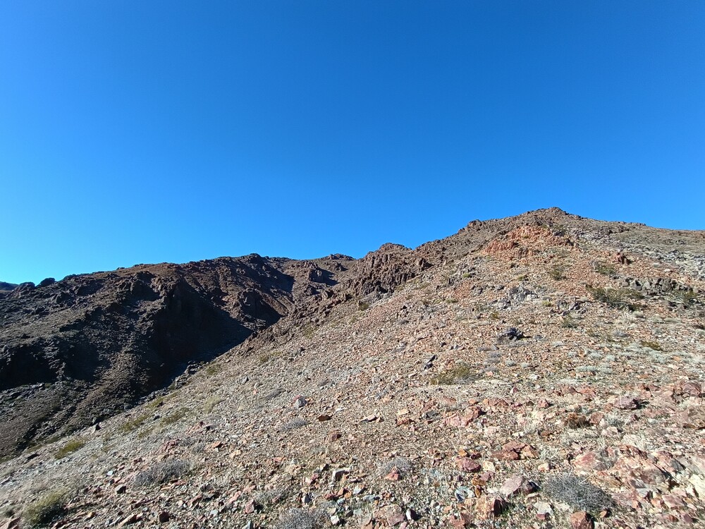
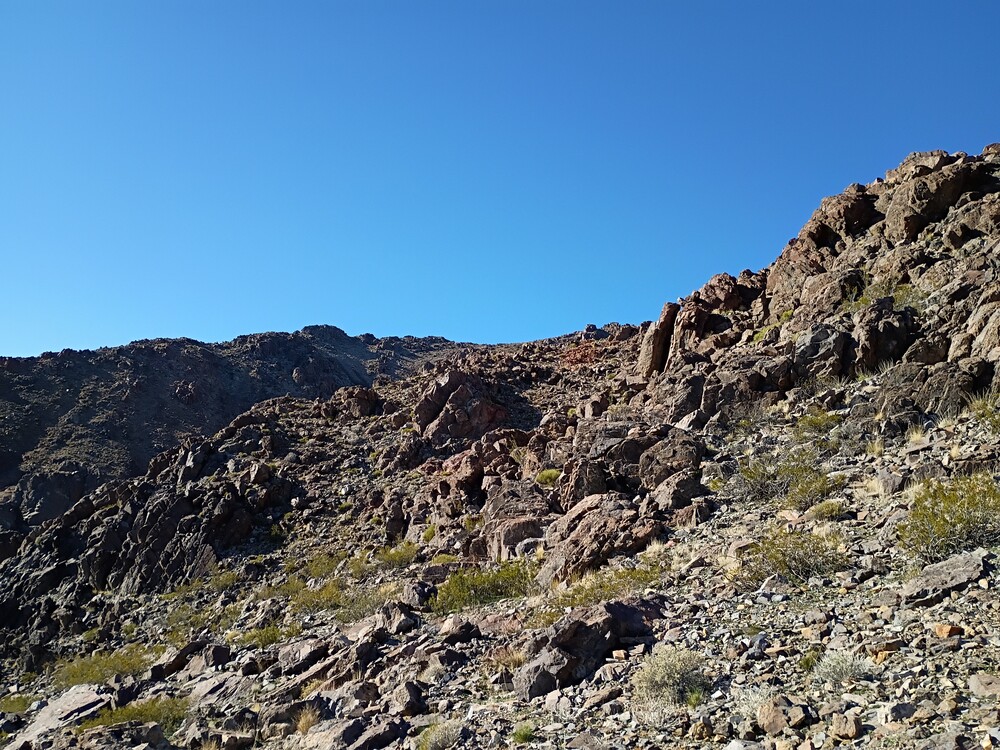
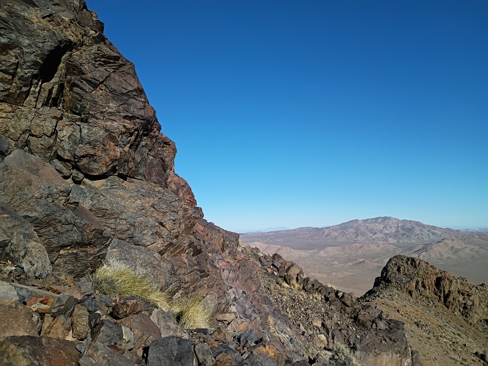
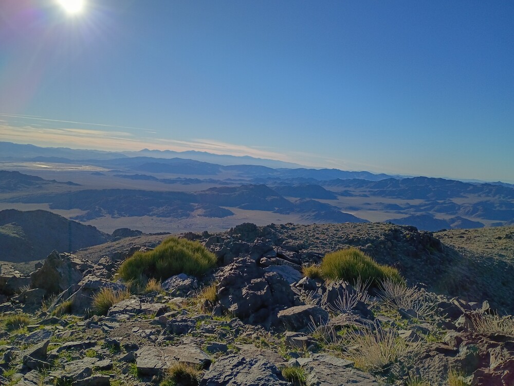
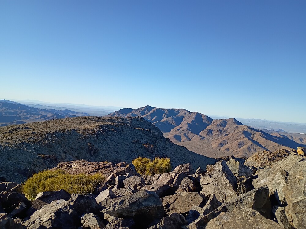
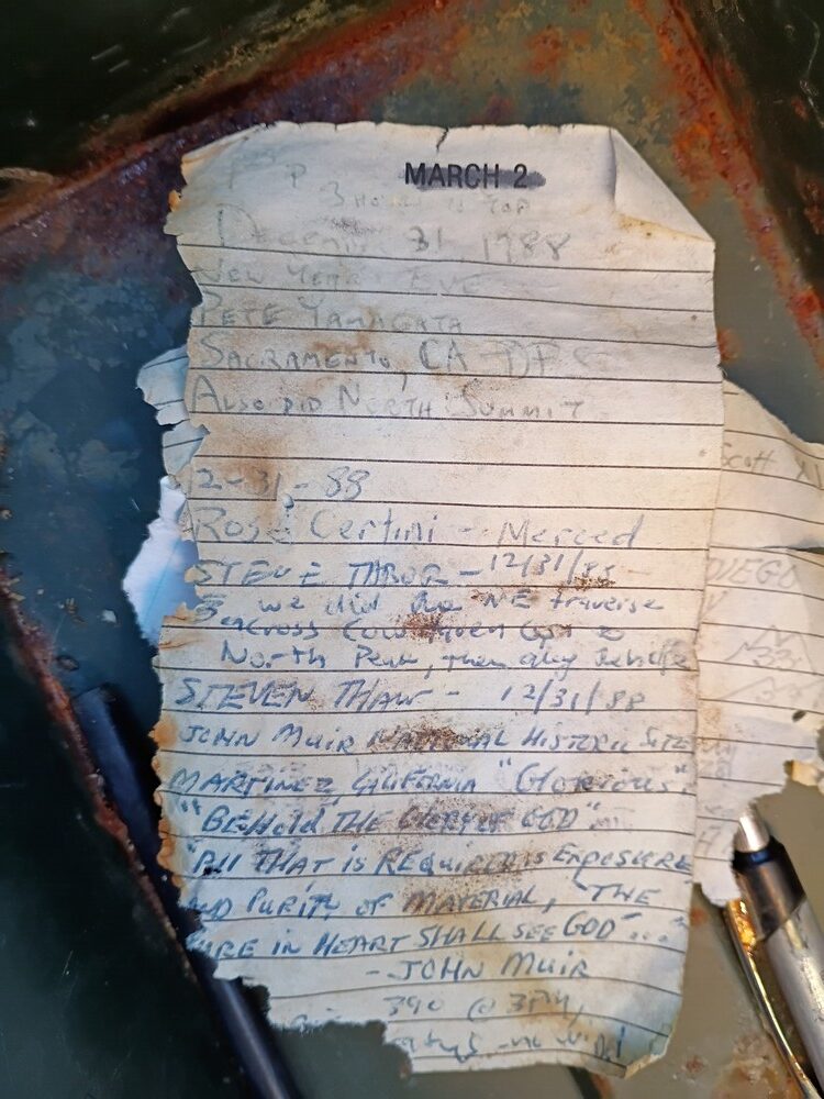
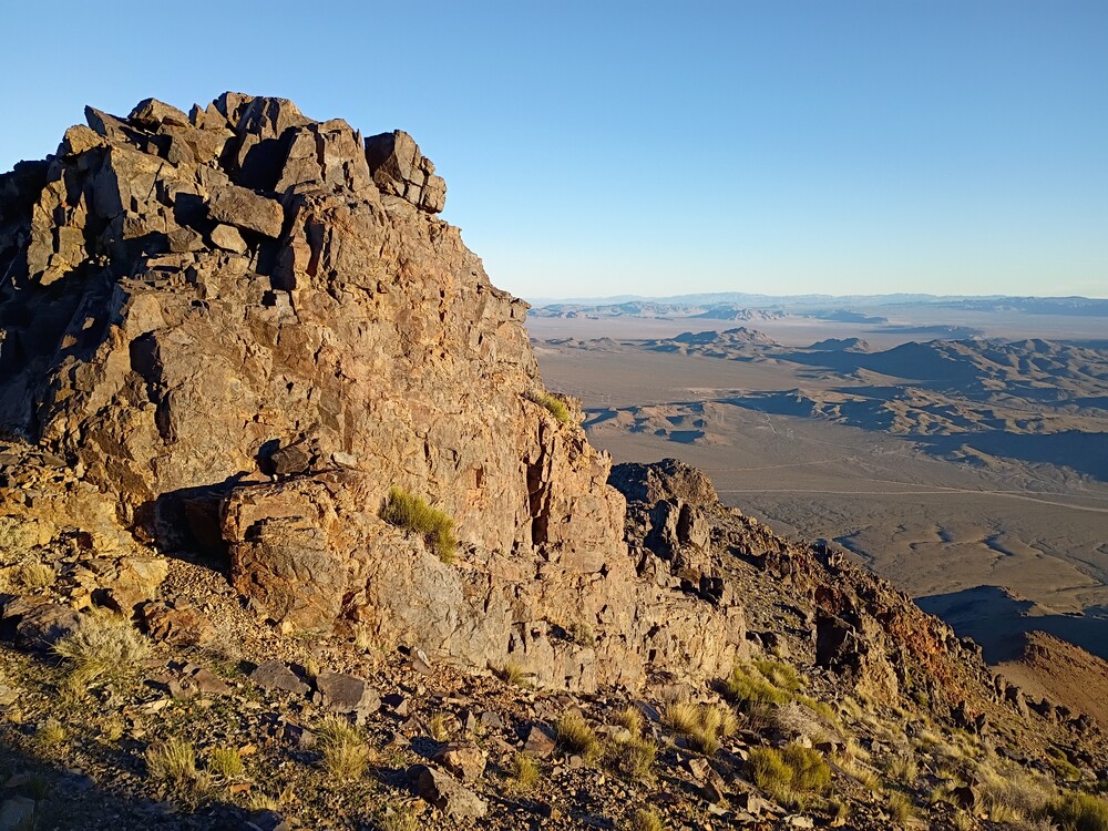
This was my second hike of the day, and second hike for the SoCal Winter SOTA fest. On the drive out to East Ord, I wasn’t paying attention to my map so I ended up in the wrong place, which is listed on a map as Grand View Mine. This would be a nice place to camp, as KB9ENS mentioned in his trip report. I wanted to start my hike from the north so I back tracked and found my way to Guzzler, as it’s listed on the map. There is no trail, and the hike starts off pretty steep. There are rock formations which make route finding tricky; I needed to backtrack several times to find a safer route. Did I mention it is steep? My definition of steep is 1000 feet of gain in 1 mile. This was something like 1800 feet of gain in a bit over a mile. It took much longer than I thought to reach the summit. At the top there was a register going back to 1988. I signed it and setup the Yaesu 817 for 2M. Made some local S2S over CW, and a few more on FM. There was a bit more time before 00:00 zulu, so I quickly setup HF, 20M and worked that as fast I could.
Since I started later than I liked, and it took me longer to reach the summit than anticipated, I was worried about losing daylight. I packed up everything and started heading down. The steep terrain and impact was hurting my knees, but I needed to beat the sun so I pushed through. About half way down, my knees really started hurting; stabbing knife pain. My stride shortened and I took breaks. The sun disappeared behind the mountains as the temperature dropped quickly. Soon, it was pitch black and the flashlight was in the truck. I still needed to navigate a dry waterfall and a wash, which was done by phone light. Luckily I was only in the dark for about 20 minutes. Had I not accidentally gone to Grand View, my timing would have been perfect.
https://sotl.as/summits/W6/SD-013
Total climbing: 2326 ft
Date:16/01/2026 | Summit:W6/SD-013 (East Ord Mountain)
| Time | Callsign | Band | Mode | Distance (km) | Notes |
|---|---|---|---|---|---|
| 23:30 | K6STR | 144MHz | CW | 115 | S2S W6/ND-224 S599 R599 |
| 23:32 | W6LOR | 144MHz | CW | 115 | S2S W6/ND-224 S55N R599 |
| 23:36 | KT5X | 14MHz | CW | S55N R57N | |
| 23:38 | K6MII | 144MHz | FM | 15 | S2S W6/SD-443 S59 R59 |
| 23:45 | N6JNY | 144MHz | FM | S55 R55 | |
| 23:47 | K6HUB | 144MHz | FM | S59 R59 | |
| 23:52 | KF7WI | 14MHz | CW | S57N R55N | |
| 23:53 | AC7P | 14MHz | CW | S55N R55N | |
| 23:54 | WW7D | 14MHz | CW | S57N R55N | |
| 23:55 | JG0AWE | 14MHz | CW | S33N R33N | |
| 23:57 | K9WO | 14MHz | CW | S55N R44N | |
| 23:58 | W0MNA | 14MHz | CW | S55N R55N | |
| 23:59 | K7SO | 14MHz | CW | S55N R55N | |
| 23:59 | W0ERI | 14MHz | CW | S599 R599 |
Date:17/01/2026 | Summit:W6/SD-013 (East Ord Mountain)
| Time | Callsign | Band | Mode | Distance (km) | Notes |
|---|---|---|---|---|---|
| 00:00 | N4TU | 14MHz | CW | S55N R42N | |
| 00:01 | WU7H | 14MHz | CW | S55N R54N |