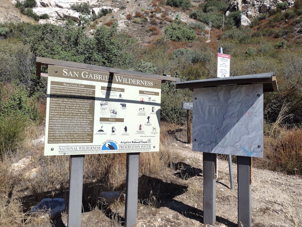
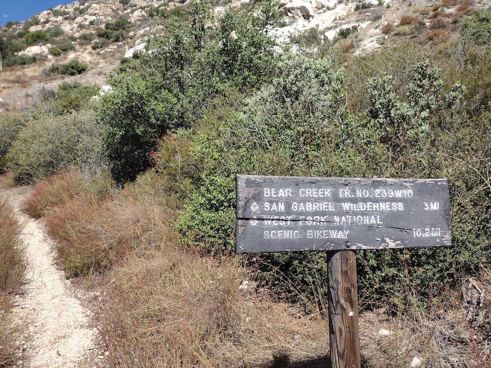
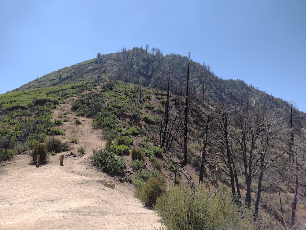
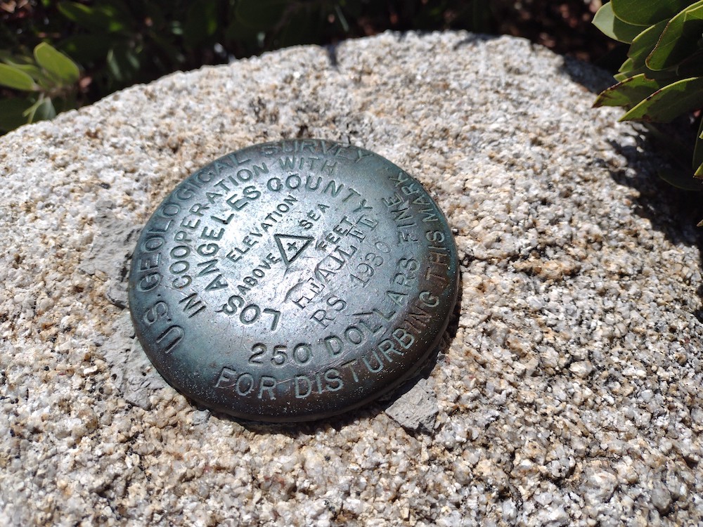
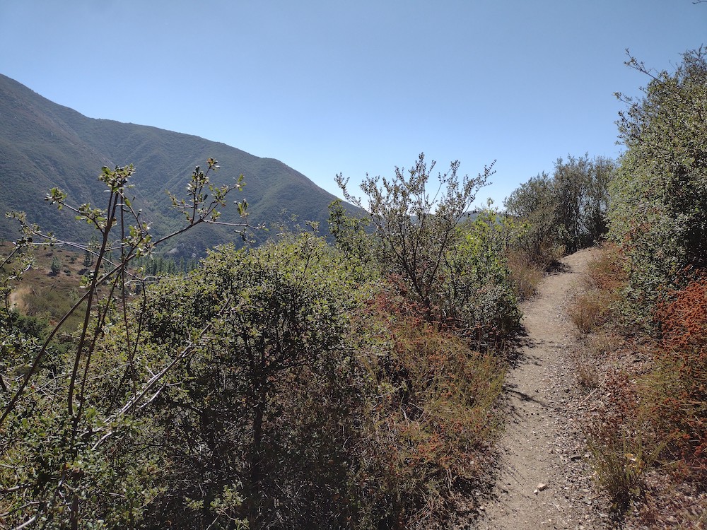
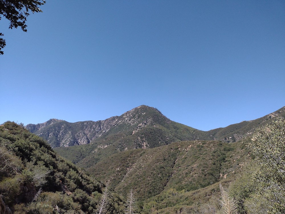
Smith Mountain has been on my list of summits to activate since I started with sota. I made an attempt to hike it the the previous year, but restrictions from the Bobcat fire were in place and the area was closed. The trailhead is easy to find; next to a pit toilet just off Hwy 39 above Azusa. From there the trail winds for three miles through beautiful canyons, gaining about 1,000 feet in elevation along the way. Once you hit the saddle, take a break because things are going to get steep. It took me some time to navigate the thick vegetation, rocks, and steep grade on this one, often finding a use trail but almost immediately loosing it. At the top, there was a benchmark and enough room to stretch out an EFHW antenna. Worked 20, 30, 40M CW and 2M FM with the HT. Coming down the mountain was a bit easier as I could locate the faint use trails a bit easier. Overall, this is a fun hike that’s accessible and close to the city. I’ll be visiting again in the future.
https://sotl.as/summits/W6/CT-120
Max elevation: 5013 ft
Total climbing: 3009 ft
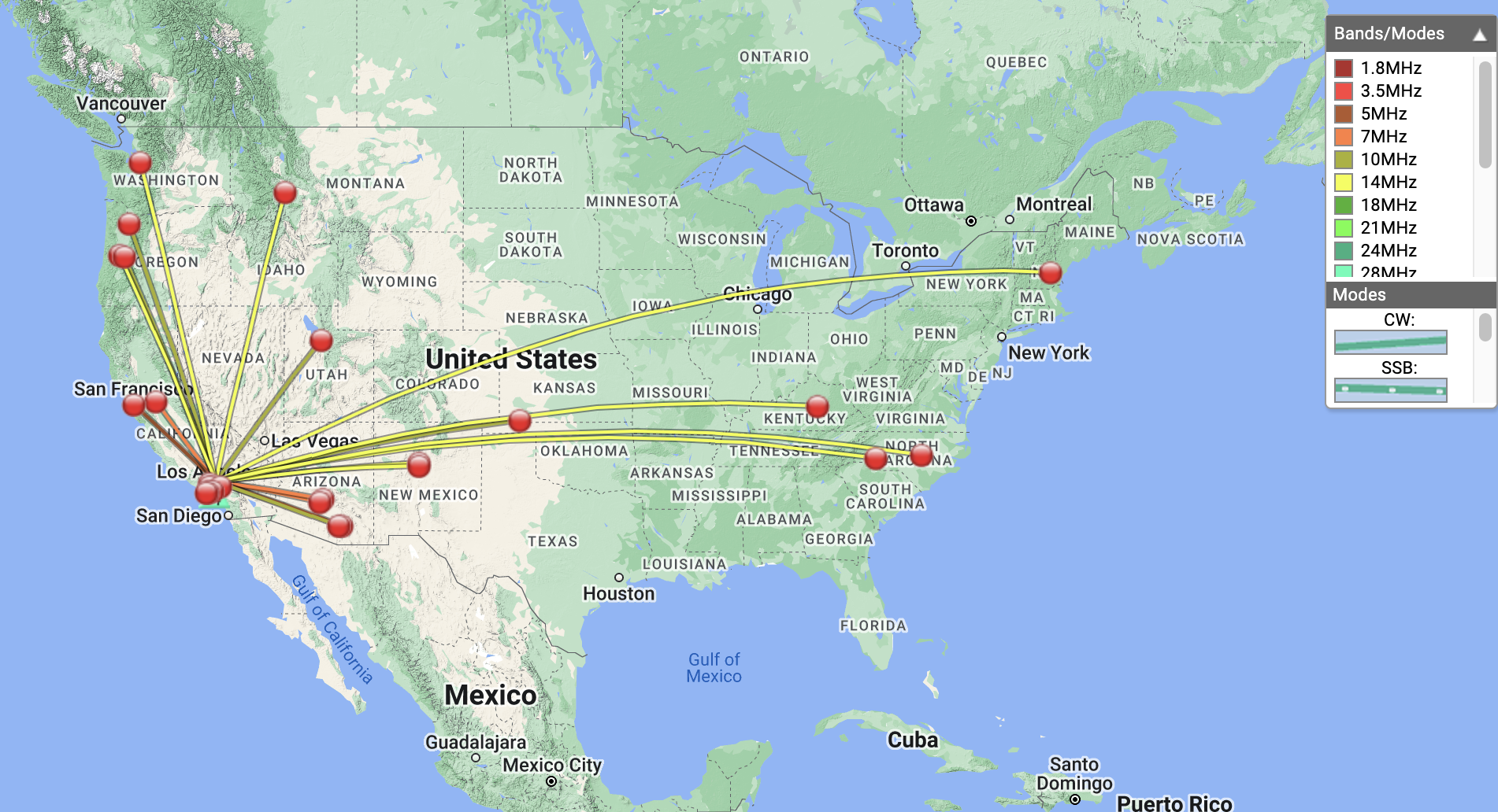
Date:16/09/2022 | Summit:W6/CT-120 (Smith Mountain
| Time | Callsign | Band | Mode | Notes |
|---|---|---|---|---|
| 20:16 | NT6E | 144MHz | FM | S59 R59 |
| 20:18 | KI6SLA | 144MHz | FM | S59 R59 |
| 20:19 | WA6WV | 144MHz | FM | S59 R59 |
| 20:25 | K6EL | 7MHz | CW | S56N R22N |
| 20:26 | KI7QEK | 7MHz | CW | S55N R55N |
| 20:27 | W7RV | 7MHz | CW | S57N R56N |
| 20:28 | NA6MG | 7MHz | CW | S57N R57N |
| 20:31 | KR7RK | 7MHz | CW | S55N R55N S2S W7A/CS-089 |
| 20:32 | N6JZT | 7MHz | CW | S32N R55N |
| 20:38 | K6YK | 7MHz | CW | S58N R57N |
| 20:41 | K6TUY | 7MHz | CW | S55N R58N |
| 20:41 | KI6PMD | 7MHz | CW | S58N R599 |
| 20:56 | WB7ULD | 10MHz | CW | S53N R56N |
| 20:57 | K6HPX | 10MHz | CW | S58N R56N |
| 20:58 | K6QCB | 10MHz | CW | S599 R57N |
| 20:59 | KI7VEM | 10MHz | CW | S51N R33N |
| 21:02 | W6TDX | 10MHz | CW | S51N R51N |
| 21:06 | K7CLA | 10MHz | CW | S52N R599 |
| 21:09 | N0RZ | 10MHz | CW | S33N R51N |
| 21:22 | N5OO | 14MHz | CW | S33N R33N |
| 21:24 | W0VQ | 14MHz | CW | S52N R44N |
| 21:25 | NM5TW | 14MHz | CW | S45N R57N |
| 21:27 | AC1Z/0 | 14MHz | CW | S51N R55N |
| 21:28 | NM5SW | 14MHz | CW | S51N R599 |
| 21:29 | W4ZXT | 14MHz | CW | S53N R44N |
| 21:32 | KR7Q | 14MHz | CW | S57N R55N |
| 21:33 | W5GDW | 14MHz | CW | S33N R33N |
| 21:35 | AB4PP | 14MHz | CW | S32N R22N |
| 21:36 | WW7D | 14MHz | CW | S56N R52N |
| 21:39 | N7CNH | 14MHz | CW | S52N R53N |