W6/SS-405 – Wyleys Knob

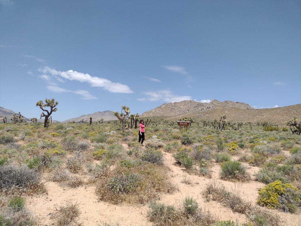
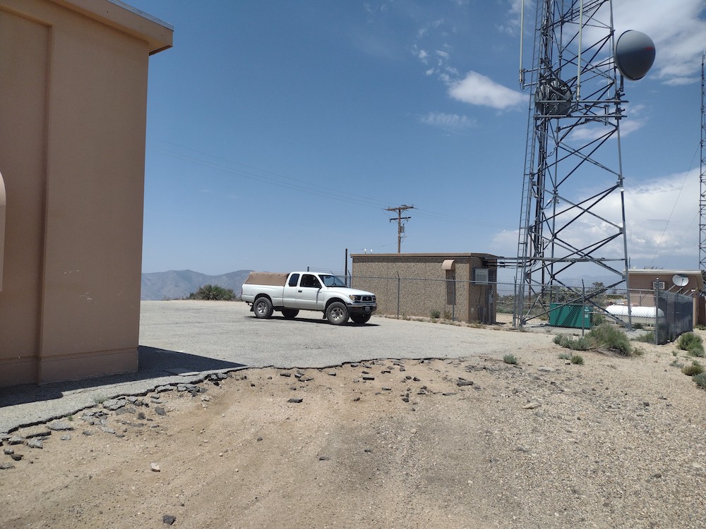
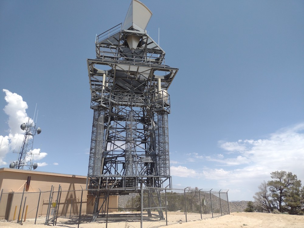
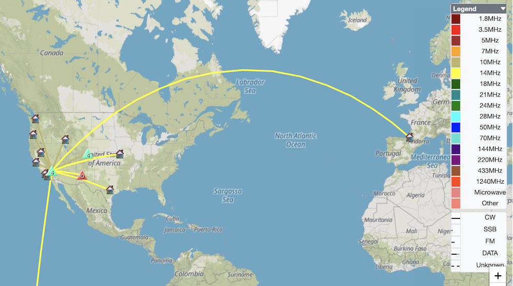
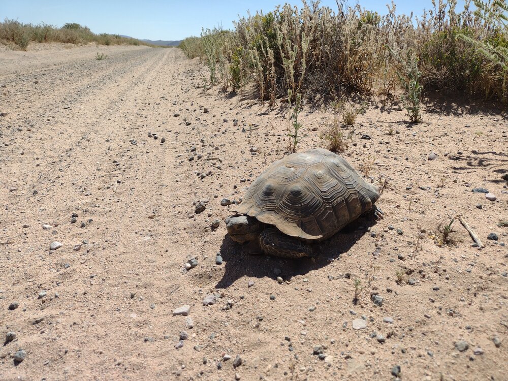
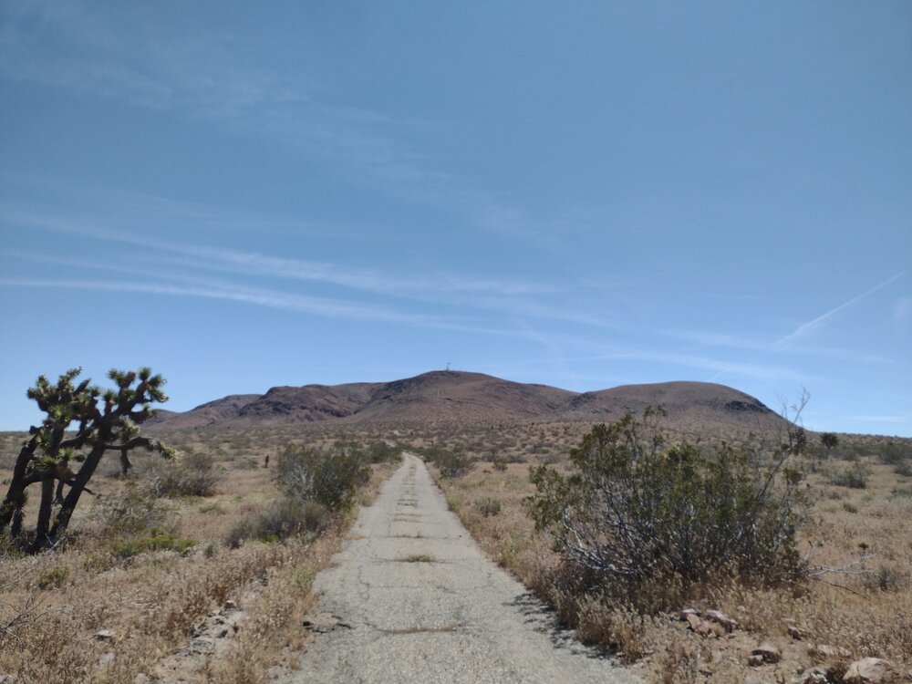
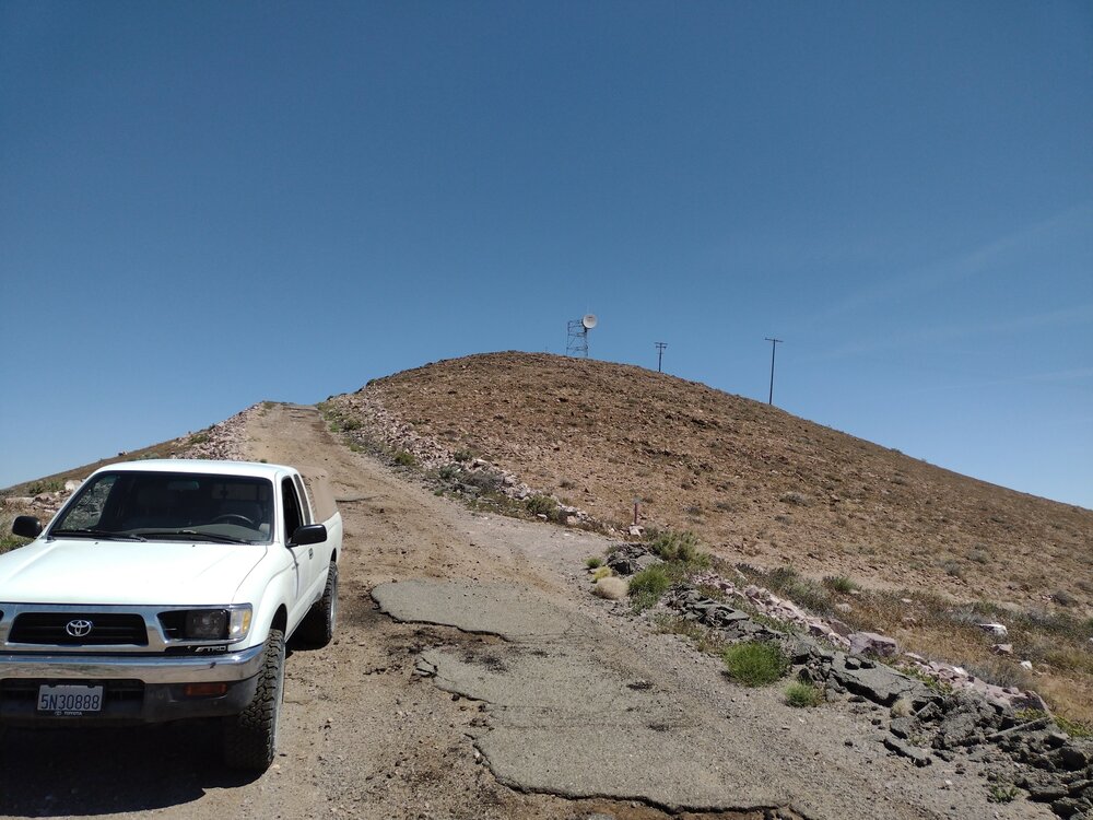
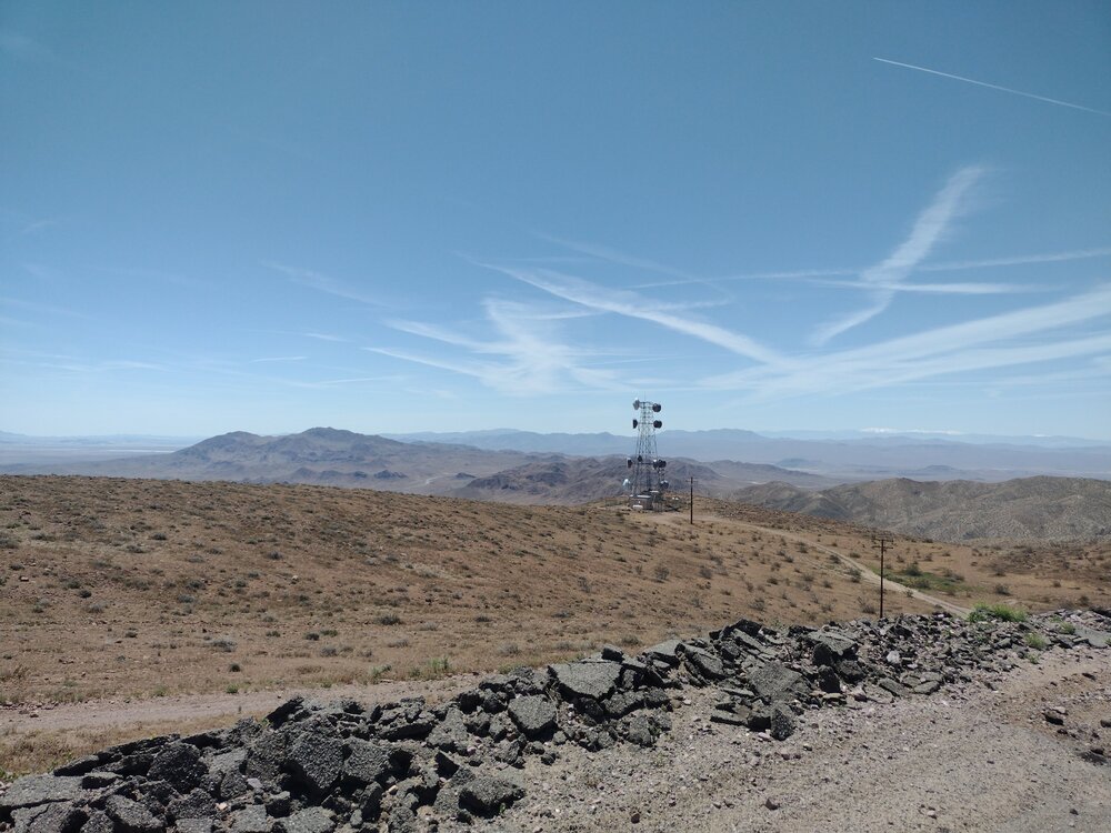
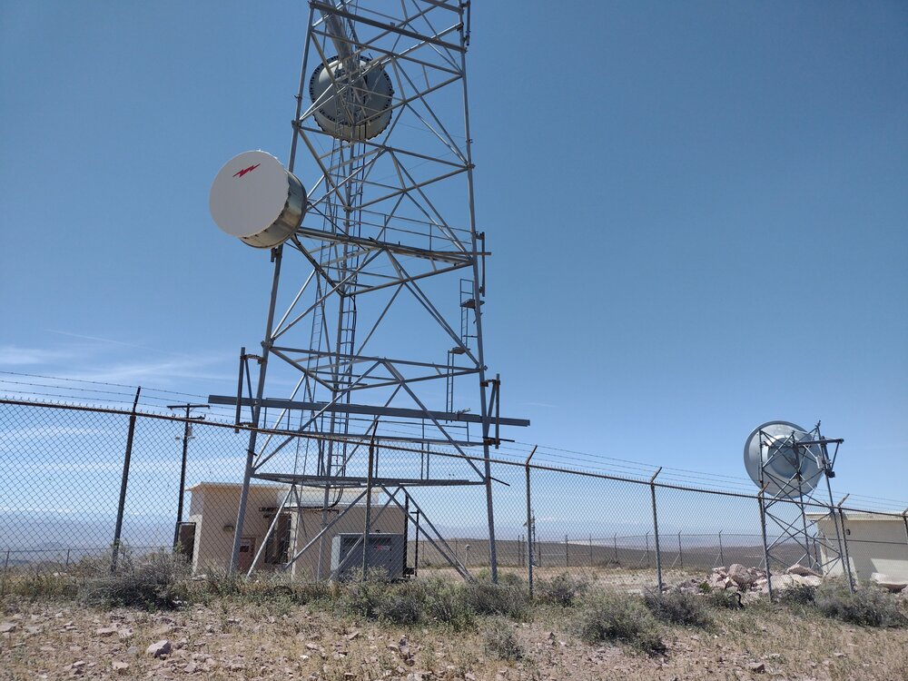
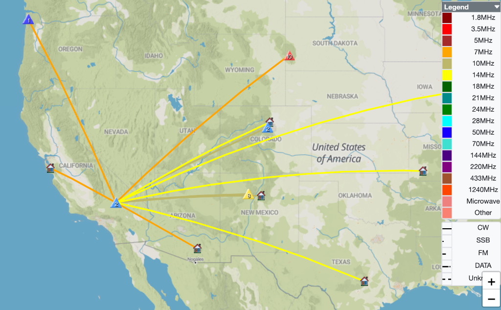
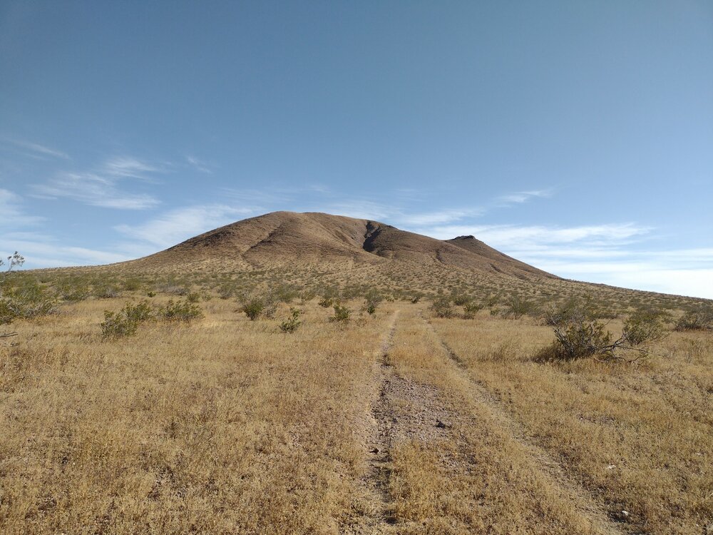
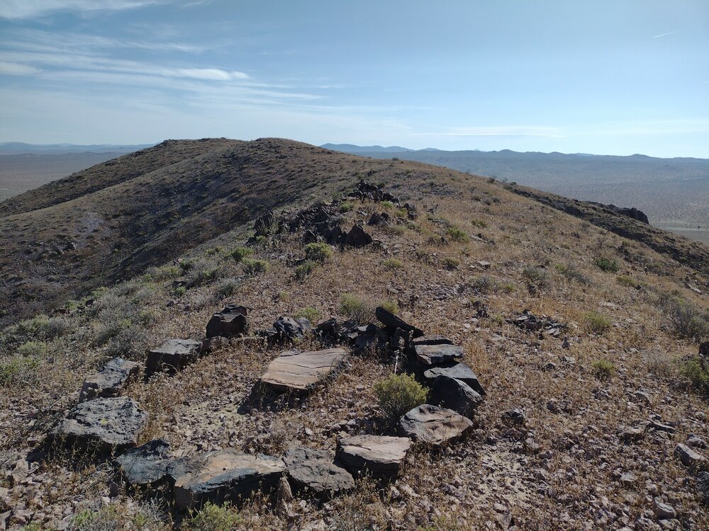
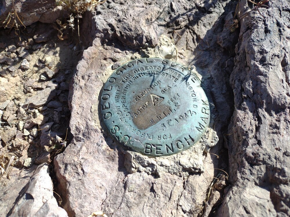
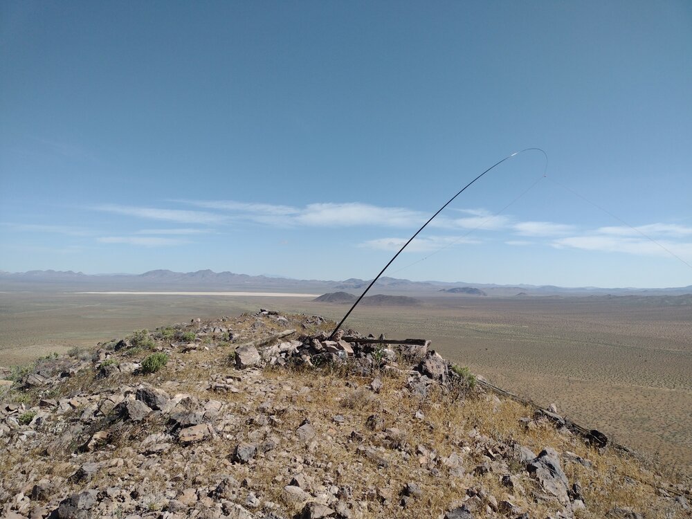
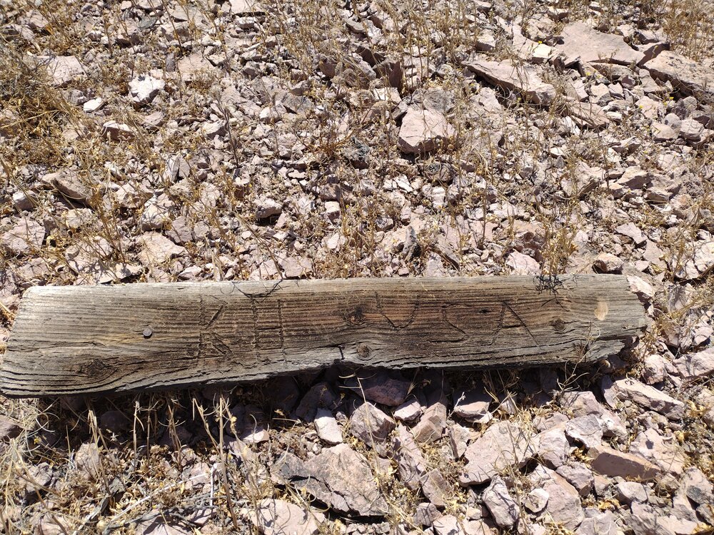
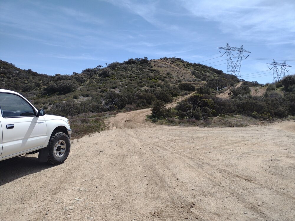
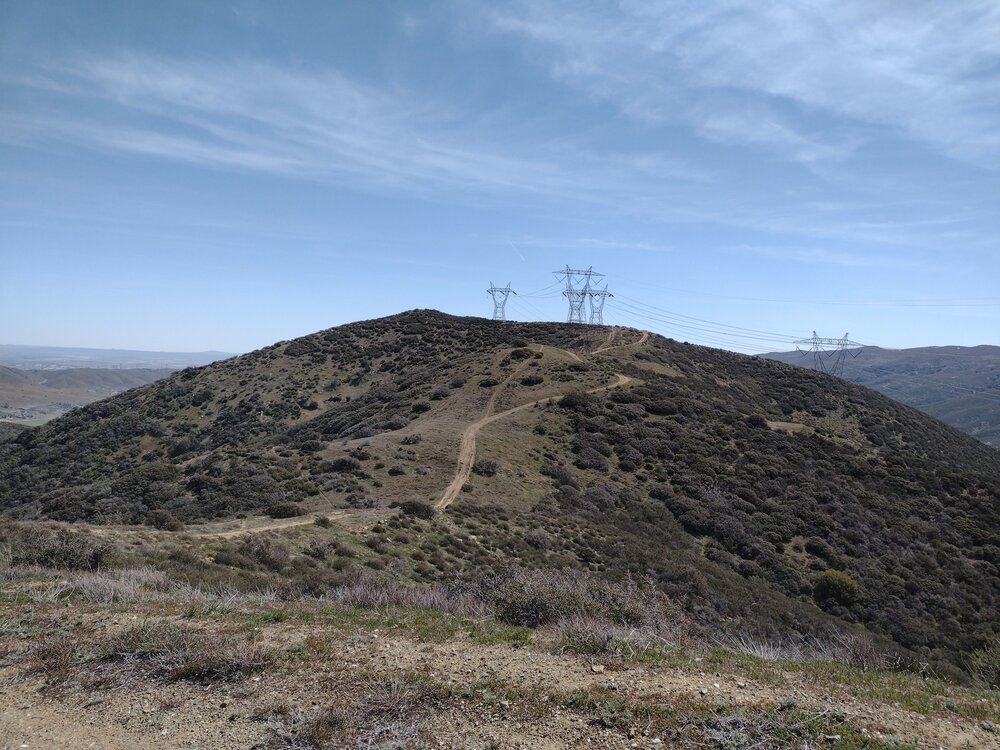
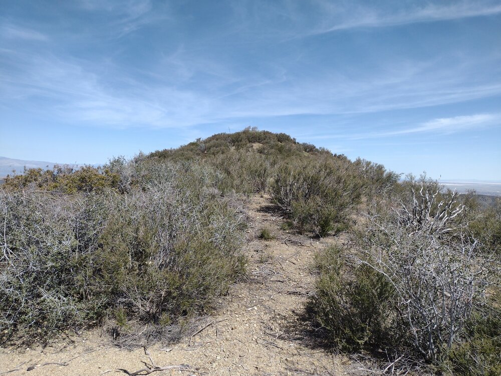
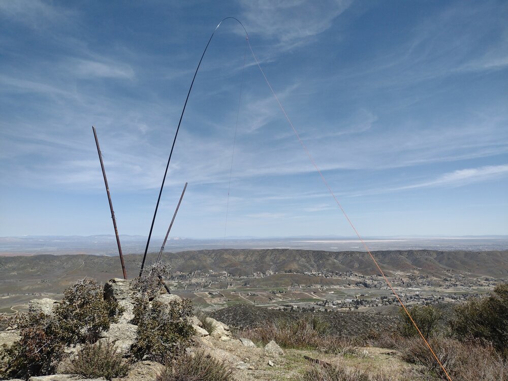
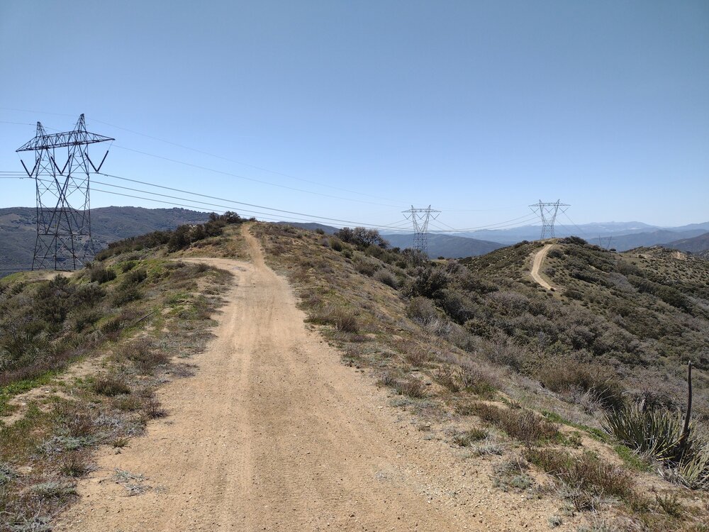
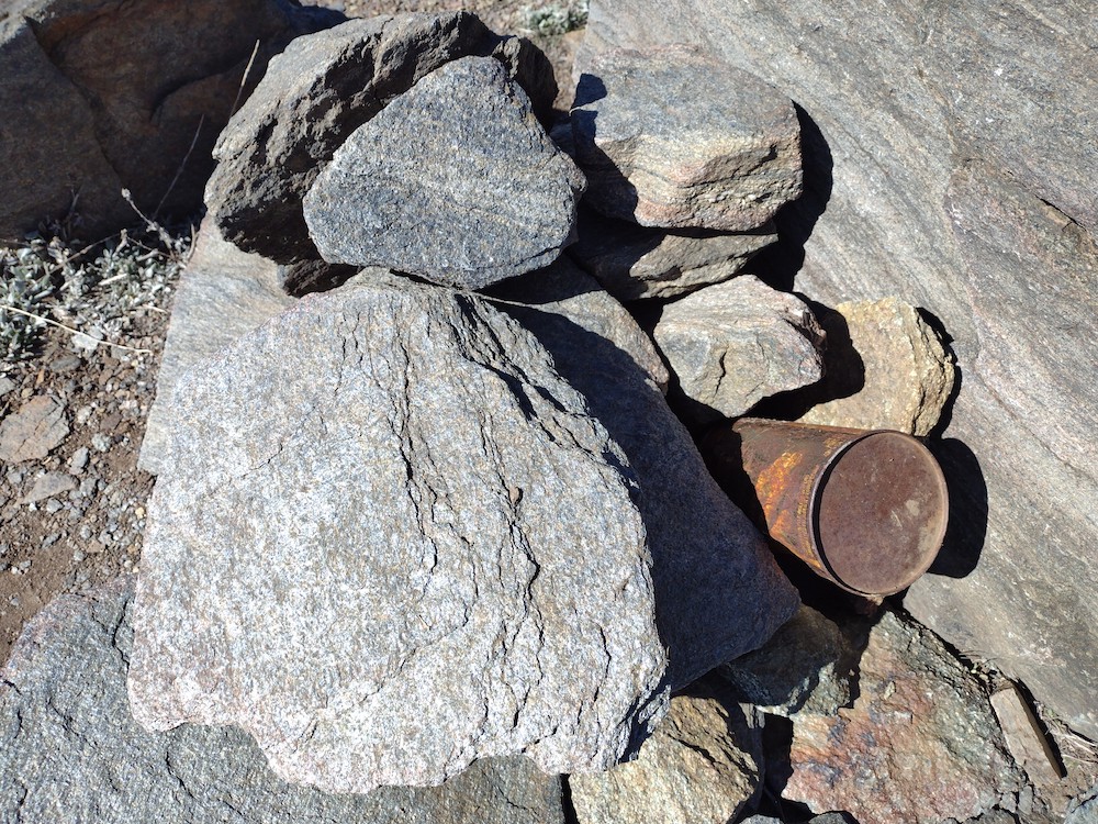
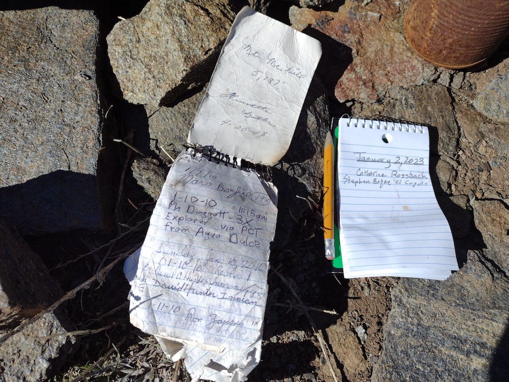
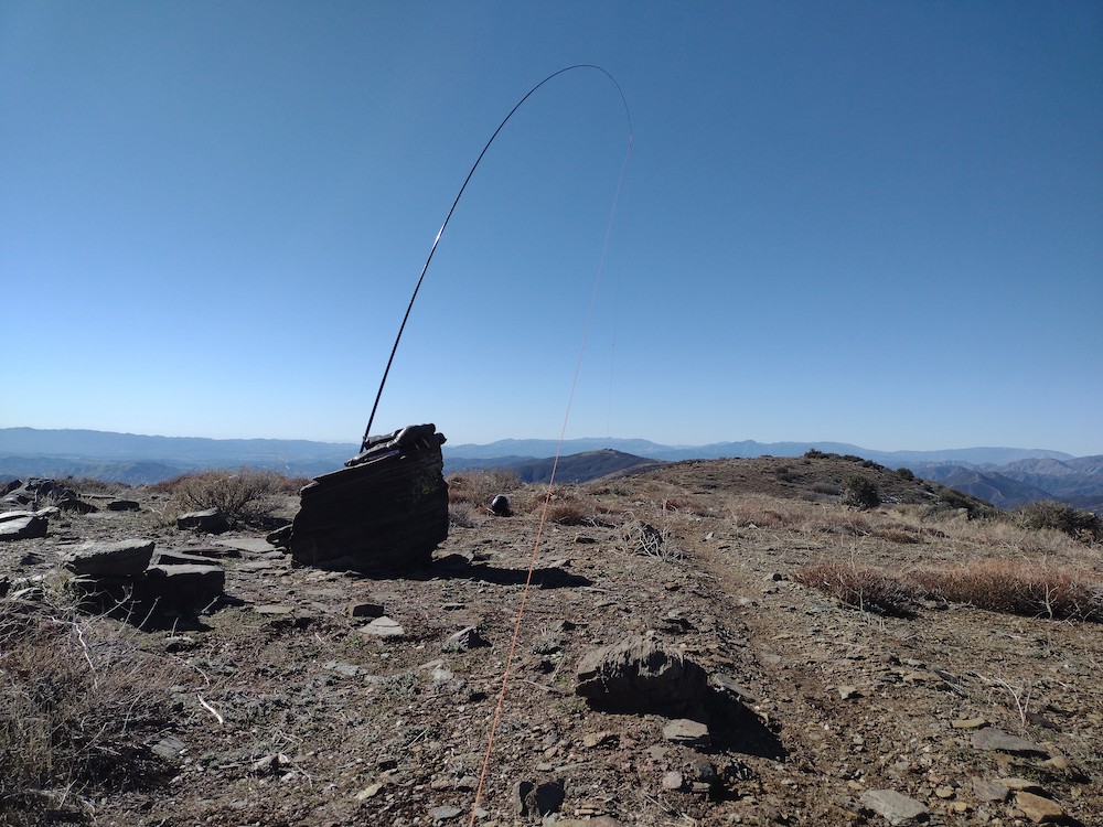
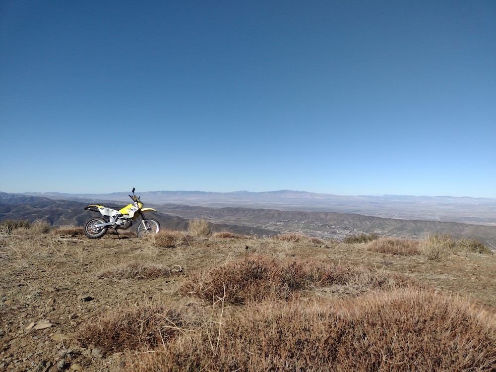
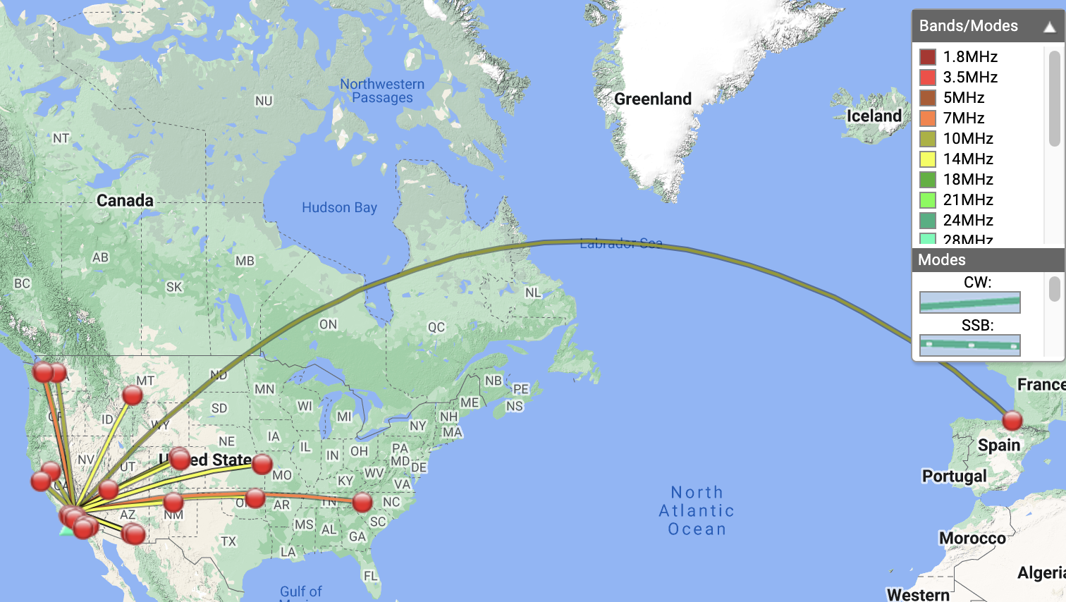
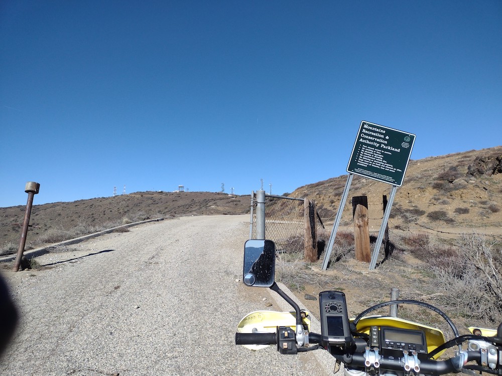
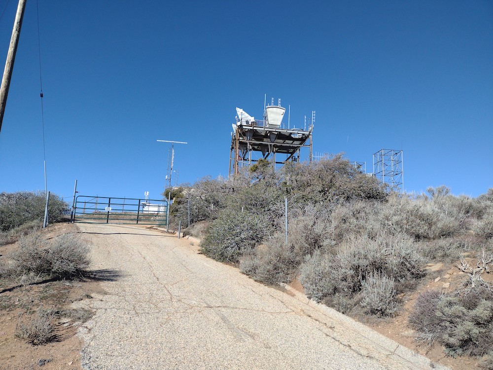
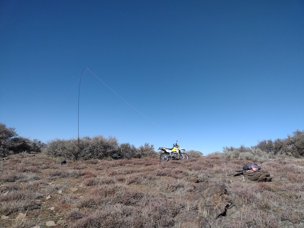
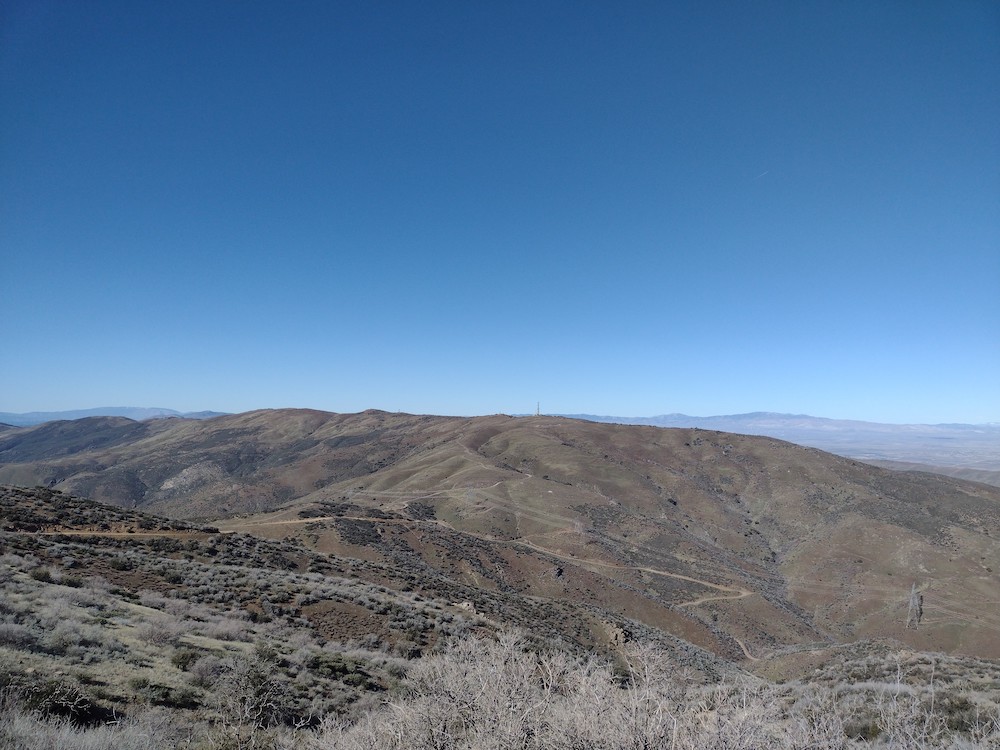
Wyleys Knob is a drive-up summit west of the 14 in the Southern Sierras. To get there, I pulled off the road into Jawbone OHV area, and wiggled my way over the California Aqueduct, past Kiavih Wilderness, and over to Bird Springs Canyon Road. From there, you go through Bird Springs pass which was well stocked with water for PCT hikers. Shortly after the PCT, make a left up to the summit. Once there, I was delighted to find an old AT&T long lines tower (I think these are neat). At the top, I found refuge from the heat in the shade of one of the equipment shelters. This didn’t allow me to setup my antenna in an optimal way, but I gave it a shot anyways. Worked three bands, 30m, 40m, and 20m, but only made 5 contacts in about 20 minutes of calling CQ. Was this solar conditions or my crummy antenna deployment? At this point, I was hungry, so I packed up and headed to a interesting rock formation with a shady tree below the summit for lunch.

https://sotl.as/summits/W6/SS-405

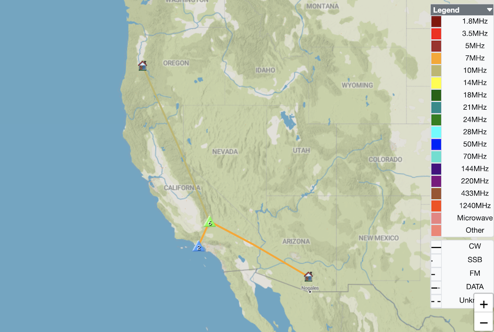
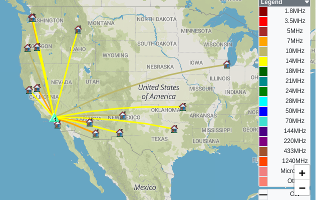
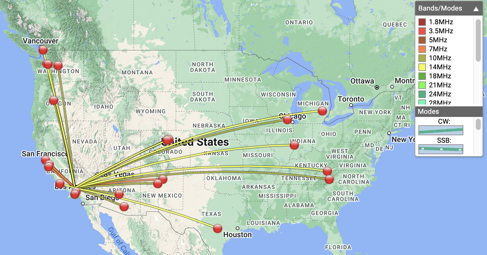
Date:20/05/2023 |  Summit:W6/SS-405 (Wyleys Knob) 

TimeCallsignBandModeNotes
19:51N6PKT10MHzCWS33N R52N
19:56W6TDX10MHzCWS33N R44N
20:04K6HPX7MHzCWS52N R51N
20:06W6LOR7MHzCWS51N R57N
20:09K6STR7MHzCWS51N R51N

W6/ND-238 – Lane Mountain

Lane Mountain is an easy drive up summit, although, I would recommend a high clearance vehicle as the road up can be kinda rough. In the sprit of SOTA, I didn’t drive up all the way, but parked just below the top and hiked up. At the top is a communications site with several microwaves. You can walk around the fence housing the facility for great views of the surrounding areas. Once there, I immediately heard a couple friends I was camping with on 2M; it was nice to get them in the log. Worked 40, 30 and 20M. After exhausting chasers, I packed up and headed home to Los Angeles.

https://sotl.as/summits/W6/ND-238

Total distance: 0.59 mi
Max elevation: 4517 ft
Total climbing: 287 ft
Total time: 01:35:58
Download file: W6_ND_238.gpx

Date:07/05/2023 |  Summit:W6/ND-238 (Lane Mountain) 

TimeCallsignBandModeNotes
18:38KM6FXK144MHzFMS33 R59
18:39AC6AT144MHzFMS35 R55
19:02K6STR7MHzCWS56N R55N
19:04NT6E7MHzCWS57N R53N
19:13N0DET10MHzCWS33N R53N S2S W0C/FR-060
19:16N0DNF10MHzCWS45N R33N
19:16WB6POT10MHzCWS57N R57N
19:17K6CPR10MHzCWS55N R41N
19:18W6TDX10MHzCWS55N R54N
19:19WW7D10MHzCWS56N R42N
19:20KH2TJ10MHzCWS58N R599
19:29W4RA14MHzCWS31N R32N
19:30W0MNA14MHzCWS45N R33N
19:31F4WBN14MHzCWS33N R599
19:32AC7P14MHzCWS32N R33N
19:33W0ERI14MHzCWS44N R44N
19:36KE5AKL14MHzCWS33N R43N S2S W5N/MG-002
19:39N7SM14MHzCWS52N R22N
19:41AF6ER144MHzFMS59 R59

W6/ND-289 – Wells Benchmark

A few times a year I camp with a group on a dry lakebed near the edge of Fort Irwin, and while I was aware of opportunities for SOTA in the area, I never activated – until Wells Benchmark. This summit is easy to find, located right off Copper City Road In addition, the hike up was easy, only taking 20 minutes or so. What made this activation difficult for me was the wind, which was extremely strong and relentless. I was able to get my antenna up and thankfully nothing got destroyed. Worked 40, 30, and 20M but didn’t make a ton of QSOs. I hiked down basically the same way. Back at the truck, I had a light breakfast and made my way over to an unactivated summit which turned out to be just on the other side of the Fort Irwin boundary fence, thus, no access.

https://sotl.as/summits/W6/ND-289

Total distance: 1.53 mi
Max elevation: 3913 ft
Total climbing: 1052 ft
Total time: 02:11:59
Download file: W6_ND_289.gpx

Date:06/05/2023 |  Summit:W6/ND-289 (Wells Benchmark) 

TimeCallsignBandModeNotes
16:03WB6POT7MHzCWS599 R599
16:05KT0A7MHzCWS33N R33N S2S W0D/BB-029
16:07K7EFW7MHzCWS33N R55N S2S W7O/NC-056
16:08KR7RK7MHzCWS56N R53N
16:10KN60MN7MHzCWS57N R53N
16:23KT5X10MHzCWS57N R57N
16:25K5DEZ10MHzCWS33N R53N S2S W5N/SE-029
16:29KX0R10MHzCWS35N R55N S2S W0C/PR-148
16:42AK5SD14MHzCWS52N R51N
16:46K0LAF14MHzCWS32N R32N
16:47KF9D14MHzCWS33N R33
16:49N0DET14MHzCWS44N R44N

W6/CT-132 – Granite Benchmark

Granite Benchmark is a summit I’ve wanted to visit for awhile but couldn’t get to with my tiny commuter car as the trail head is down a long fire road. Sadly, the clutch in the car was going out and the replacement cost exceeded the value of the vehicle. In addition to the clutch, it needed a bunch of other work so it made sense to sell the car and buy something else. I ended up with a 1st gen Toyota Tacoma 4×4, manual everything. So far, it’s a rad truck.

From Bouquet Canyon road, I turned on the forbidden Leona Divide fire road and headed to the trailhead, where there was a large clearing and plenty of room to park and not get in anyone’s way. The hike it’s self it pretty easy; It follows a power transmission line service road around a mile and a half one way, and maybe 700~800′ of elevation gain. Close to the summit, you cross under the lines and follow a short use trail to the top. On this particular day , it was extremely windy. I had a difficult time getting my wire antenna up. In addition, my mast broke twice. Worked 40M, 30M, and 20M CW. No S2S from this peak. After packing up and heading back to the truck, I continued my way down Leona Divide to activate Burn Benchmark, one I’ve previously activated before via mountain bike. You can read about that here.

https://sotl.as/summits/W6/CT-132

Total distance: 2.49 mi
Max elevation: 4621 ft
Total climbing: 957 ft
Total time: 02:23:34
Download file: W6_ct_132.gpx

Date:06/04/2023 |  Summit:W6/CT-132 (Granite Benchmark)

TimeCallsignBandModeNotes
19:13KF6HI7MHzCWS52N R52N
19:15KN6RDC7MHzCWS55N R599
19:17NT6E7MHzCWS58N R53N
19:17KN6OMN7MHzCWS57N R55N
19:19AI6XG7MHzCWS56N R44N
19:22WU7H7MHzCWS22N R22N
19:23K6HPX7MHzCWS33N R51N
19:35W6TDX10MHzCWS44N R44N
19:37K5DEZ10MHzCWS42N R42N
19:40N9KW10MHzCWS22N R339
19:47N7EDK14MHzCWS33N R33N
19:47WW7D14MHzCWS52N R53N
19:49W6STR14MHzCWS51N R57N
19:52W0JSR14MHzCWS45N R31N
19:53W5BOS14MHzCWS45N R33N
19:55KG5ES14MHzCWS42N R55N
19:56NW7E14MHzCWS33N R55N
19:59N7BYD14MHzCWS44N R44N
20:00W5ODS14MHzCWS45N R55N

W6/CT-118 – Mount McDill

This was my second summit of the day, having just come from Sierra Pelona. You can read about that summit here. I’m kinda glad I didn’t ride a mountain bike over to this summit like I had original planned, as there is some steep elevation to tackle on the way out. That being said, I think there are a few other ways up here that might be a bit easier on a bike than the was I took the moto. The top was easy to find, I looked around for a benchmark, but couldn’t find one. I did find a register going back to 2008 which I didn’t expect to see. I used the pile of rocks to support my antenna mast. I worked 40M, 30M ,and 20M with 4 S2S. Thanks! While I didn’t really notice at the time, where I was setup was almost directly on a moto trail. A group of bikers stopped for a minute to take in the great views, and luckily my antenna didn’t get snagged on anything. Wanting to explore the area bit more, I packed up and headed out after working all the chasers.

https://sotl.as/summits/W6/CT-118

Date:28/01/2023 | Summit:W6/CT-118 (Mount McDill)

TimeCallsignBandModeNotes
21:06KN6OMR7MHzCWS57N R599
21:08KX0R7MHzCWS31N R33N S2S W0C/FR-102
21:10N6AN7MHzCWS58N R57N S2S W6/CT-225
21:10WU7H7MHzCWS559 R339
21:11K6EL7MHzCWS56N R52N S2S W6/CC-072
21:13NT6E7MHzCWS58N R559
21:14N6GO7MHzCWS55N R599
21:15KE6MT7MHzCWS57N R55N
21:18AD6VT7MHzCWS57N R599
21:19KT5X7MHzCWS57N R33N
21:31NW7E10MHzCWS519 R55N
21:32N7EDK10MHzCWS44N R55N
21:33N4LAG10MHzCWS56N R56N
21:34KF6HI10MHzCWS57N R58N
21:35NU7A10MHzCWS44N R32N
21:38KF9D10MHzCWS53N R33N
21:39W0MCB10MHzCWS44N R33N
21:40WB5USB10MHzCWS51N R55N
21:53W9MRH14MHzCWS52N R55N
21:55WW7D14MHzCWS57N R54N
21:55NE4TN14MHzCWS51N R44N
21:57KD8DEU14MHzCWS52N R22N
21:58VE7HI14MHzCWS51N R33N
21:58AC7P14MHzCWS44N R55N
22:02N6WT14MHzCWS21N R33N S2S W6/SC-171
22:03KX0Y14MHzCWS51N R44N
View of Mt. McDill from Sierra Pelona
Register, wasn’t expecting to find one here.
Placed in 2008
Antenna setup
Moto and the Antelope Valley

W6/CT-116 – Sierra Pelona

Last summer I installed a new rear tire on my dual sport moto, rode it around the block once, parked it in the back yard, then promptly forgot about it over the wet winter. I’ve wanted to visit Sierra Pelona and Mt. McDill for some time, with the idea to take the mountain bike up there on a cool winter day. Well, the moto was in the back yard all sad, full of spiders, chain rusted, and had a dead battery. What better way to wake the bike up for the next season than a 100 mile round trip SOTA activation? After hosing the bike off, evicting the spiders, installing a new battery and applying copious amounts of gear oil on the chain, the ole’ DRZ was ready to go. I left my house in Echo Park and headed up Hwy 2, made a left on Angeles Forest Highway, over to Acton and up the road to Sierra Pelona. The road up was somewhat steep, but paved, which caught me by surprise. I was under the impression you needed a truck or something to get up there. At the top there is a radio installation, including a AT&T long lines tower. This isn’t where the summit is though, it’s further along the ridge, and the road isn’t paved at this point. I think a regular car would still be fine. At the summit, I looked around for a benchmark, but couldn’t find one. I setup my EFHW antenna and started working the bands, 40M, 30M, and 20M + 5 S2S. After exhausting the chasers, I packed up my gear and headed over to Mt. McDill a few miles away.

https://sotl.as/summits/W6/CT-116

Date:27/01/2023 | Summit:W6/CT-116 (Sierra Pelona)

TimeCallsignBandModeNotes
19:03N6AN7MHzCWS58N R57N S2S W6/CT-225
19:03KF7HP7MHzCWS55N R33N
19:04NT6E7MHzCWS56N R55N
19:05K6TUY7MHzCWS599 R599
19:06K6KY7MHzCWS57N R55N
19:07NJ6Q7MHzCWS56N R599
19:09K6KMH7MHzCWS56N R559 S2S W6/SC-456
19:10K6CPR7MHzCWS57N R55N
19:11KR7RK7MHzCWS52N R55N
19:12K6CWC7MHzCWS57N R599
19:12N4LAG7MHzCWS559 R559
19:14WU7H7MHzCWS44N R52N
19:16WC6KD7MHzCWS52N R55N
19:31K6EL10MHzCWS52N R55N S2S W6/CC-072
19:33KX0R10MHzCWS32N R53N S2S W0C/FR-102
19:34NU7A10MHzCWS51N R31N
19:35N6PKT10MHzCWS51N R55N
19:36AI6XG10MHzCWS51N R57N
19:37NU7Y10MHzCWS559 R579
19:39N0DET10MHzCWS42N R53N S2S W0C/SP-117
19:56W0JSL14MHzCWS56N R54N
19:56W0MNA14MHzCWS56N R55N
19:57KT5X14MHzCWS55N R55N
19:57W0ERI14MHzCWS56N R55N
19:58N7WM14MHzCWS52N R599
19:59N7EDK14MHzCWS55N R55N
20:00F4WBN14MHzCWS55N R599
20:02W5ODS14MHzCWS56N R56N
20:03WW7D14MHzCWS56N R56N
An old Long Lines station
Mount McDill